Rawah Wilderness (part 2)
Started: 2008-07-22 14:46:57
Submitted: 2008-07-22 15:36:36
Visibility: World-readable
My adventures in Rawah Wilderness start here: Rawah Wilderness (part 1).
Friday, 18 July 2008
I woke up on Friday morning deep within Rawah Wilderness in the West Branch of the Larimer River drainage. I set out to build a fire to heat water for oatmeal and coffee for breakfast but had more trouble than I anticipated actually getting the fire to start; the wood was still a bit damp from the rain the previous night, and the air had stayed fairly humid after the rain. I finally got the fire started and brought a liter of water to boil. I let the fire burn down; when it was out I headed back to my tent and broke camp, then returned to clean up my fire site. I scattered the unburnt fire wood and ashes around the small clearing and generally put the site back into the shape it was when I arrived.
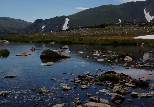
I carried my pack across the river, stashed it behind a tree, pumped water for the first phase of my hike, and headed up the West Branch Trail to the end of the canyon, which held Carey Lake and Island Lake above timberline. At the end of the trail, I misread my map and thought that Carey Lake was in a shelf above me, so I crossed a stream and climbed a few hundred vertical feet until I discovered that the shelf was an incomplete glacial moraine and that the lake I crossed was in fact Carey Lake. I headed back down the tundra, crossed the stream at the mouth of Carey Lake, and crossed the cirque to Island Lake. As advertised, the lake did in fact have an island, which rose sharply from the surface covered in vegetation.
I returned down the trail, past a pair of campsites clearly visible from the trail and much closer than the required 200 foot separation. (To make matters worse, they had an obvious campfire in the alpine exclusion zone above treeline.) I retrieved my pack from behind its tree, pumped more drinking water for my trip down the canyon, and headed down the West Branch Trail. Five and a half miles later, I emerged at the Tunnel Campground, next to the West Branch Trailhead. It felt a bit odd to be walking, without a car and with a full backpack, down the dirt roads making up a developed Forest Service campground. I found a suitable campsite, dropped my pack on the picnic table to claim the site, walked to the campground entrance to pay for the site, and returned to set up camp. The designated tent pad was flat and dry, but it was a bit rocky; I could feel small rocks through the bottom of the tent until I inflated my sleeping bag's air core, and I had to grab a rock to hammer the tent stakes into the ground.
With my tent set up, I settled in to wait for Kiesa to show up after work. The campground filled up by 1700, earlier than I expected, since it didn't seem to allow for the after-work crowd to make it up the Poudre. My plan was to eat supper but I was out of camp fuel, so I had to wait for Kiesa to arrive with camp fuel. She arrived at 1930, just as I was thinking about returning to the audiobook of The House of the Scorpion, which kept me occupied when I ran out of podcasts. Kiesa brought camp fuel and PF Chang's takeout. I boiled water for my backpacking meal and shared her takeout before retiring to the tent for the night.
For more photos, see Photos on 2008-07-18.
Saturday, 19 July 2008
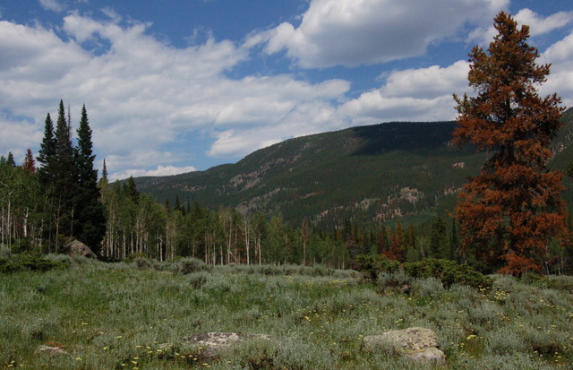
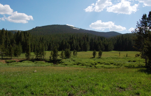
Having completed my exploration of the southern half of Rawah Wilderness, my attention turned to the lower, densely-forested northern half. After breakfast, Kiesa and I retrieved Motoko from the Blue Lake Trailhead to the south, then returned to camp to drop off Yoda and drive further north, along the Laramie River, to the Link-McIntyre Trailhead. We headed up the McIntyre Trail, which followed McIntyre Creek deep into the wilderness. The scenery in the narrow canyon was dominated by the dense evergreen forest and the roar of McIntyre Creek. We ate lunch in Housman Park, populated mostly by mosquitos, and continued up the trail towards Shipman Park. The park was obvious on my map but it wasn't clear how close the trail would get; my guidebook suggested I might only get a "glimpse" of the huge natural meadow. We caught the glimpse though the trees from the old roadbed on the forested hillside above the meadow and decided that was good enough; we had come roughly seven miles, so it seemed like a good idea to turn around. Kiesa declared a nearby log our ultimate destination; we reached the log, declared victory, and turned around.
In the evening, back at the campsite, my attention turned to my next outing, which I expect to undertake in the next week. My first thought involved the Maroon Bells-Snowmass Wilderness, though the vast throngs of tourists flocking to the Maroon Bells does dampen my enthusiasm for the area.
For more photos, see Photos on 2008-07-19.
Sunday, 20 July 2008
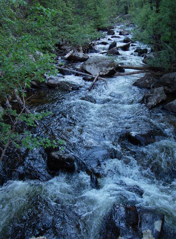
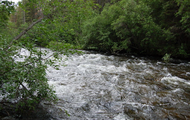
On the last day of my five-day expedition, we ate breakfast, broke camp, and headed up the Laramie River valley, past Chambers Lake, and turned east towards the Cache La Poudre River. We parked at the Big South Trailhead and followed the Big South Trail up the Cache La Poudre River into Comanche Peak Wilderness. The Wild and Scenic River was wide and deep as it cascaded down the canyon. The river and the canyon dominated the scenery early in the hike, before the canyon grew wider and trees covered the canyon floor. Seven miles in the trail crossed the river without a bridge; the bridge was destroyed in a flood and never rebuilt, which I attributed to a decision by forest managers to mitigate the number of people hiking through the canyon. (In mid-July, the river looked about three feet deep and flowing swiftly.) We declared victory, ate lunch, and headed back down the trail. It started raining as we descended; I pulled out my rain coat for most of the hike downstream and wished I had brought my breathable (but heavier and more bulky) rain coat instead.
Two-thirds of the way down the canyon, the rain finally abated. We emerged from the canyon at 1600, having covered fourteen miles in six hours. I exchanged my boots for sandals and drove down the canyon and ultimately home, pleased to return to civilization and showers after my latest wilderness adventure.
For more photos, see Photos on 2008-07-20.
