Jasper
Started: 2009-09-24 21:04:06
Submitted: 2009-09-24 22:17:12
Visibility: World-readable
My employer believes in giving engineers solo offices. This is generally a good thing -- it lets me cut out the loud people down the hall, and I don't have to find a conference room when I need to have a private phone conversation. Having my own office, though, includes one unanticipated consequence: I have vast square feet of wall space to fill.
A couple weeks after getting my office last year, I picked up four USGS 7.5" quads: Monarch Lake, Ward, East Portal, and Nederland. These four maps contain the core of Indian Peaks Wilderness and the backbone of the Continental Divide through Boulder County. (I left enough space to hang the Isolation Peak and Allenspark quads in the correct geographical alignment on my wall.) These maps represent the core of my backyard playground and present a not-inconsequential distraction.
While staring at the map a few weeks ago, looking at the highest peaks in Indian Peaks Wilderness and contemplating long loop hikes, I realized that I need not exclude the gentle length of the Continental Divide between Arapaho Pass and Devils Thumb Pass simply because there wasn't a trail there. (The class four north ridge of Mount Neva presents the only real obstacle.) It didn't take long for a route to come into focus: four miles along the Continental Divide between the two passes incorporating three ranked summits. I tend to prefer loop hikes, and my experience climbing Mount Alice and Mount Meeker reminded me that I don't mind long approaches to summits but I'm not particularly fond of long descents. With that in mind, I laid out a 7.5 mile approach to Devils Thumb Pass from Fourth of July Trailhead and a modest 3 mile return from Arapaho Pass.
It rained in Longmont on Saturday, 12 September and snowed at higher elevations. I was worried about how snow would affect my route; I didn't want to descend Neva's class three northeast slopes if there was any sort of snow, and I didn't see many easier options for descending Jasper early. All I had to go on was the Weather Service's forecast of "up to an inch of accumulation" when I set out early Sunday morning.
I wanted to be off the ridges by early afternoon to avoid afternoon thunderstorms, so I woke at 05:00 and drove up Boulder Canyon in the pre-dawn gloom. I ate breakfast in my car at the Fourth of July Trailhead at sunrise (which was a bit less transcendent than breakfast at Chasm Lake a month prior) and headed up the trail at 07:00. The ground was crisp from frost as I made my way up the Arapaho Pass Trail to the Diamond Lake Trail. I caught scattered glimpses of Mount Neva and Mount Jasper through the trees as I climbed, but the best view was of Arapaho Peak across the valley from Diamond Lake.

The Diamond Lake Trail took me past Diamond Lake on a direct route to Jasper Lake. When the trail broke above treeline, I saw a low cloud cover over the plains.
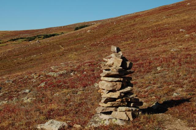
I joined the Devils Thumb Trail and passed Jasper Lake and Devils Thumb Lake on my way to Devils Thumb Pass. The trail skipped the snowfield on the east side of the pass; I followed the trail back to the pass and looked north to see where my off-trail adventure would take me.
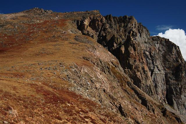
My first summit was Point 12,660, an unnamed ranked summit (14th in Indian Peaks Wilderness, 886th in Colorado) straddling the Continental Divide between Boulder and Grand Counties. The tundra slope was gentle at first but gave way to scattered talus that gave way to pure talus as I skirted the false summit and pressed on to the real summit. I rested, ate an energy bar, and searched unsuccessfully for a register. I had achieved my first summit, but more awaited.
I continued north along the Divide, descending to the col between Point 12,660 and Mount Jasper before ascending the ridge to my expedition's high point. On the East Portal quad on my wall, Mount Jasper merits only an elevation (12,923 feet) even though it ranks as the quad's highest summit and the 10th highest summit in Indian Peaks Wilderness.
From the summit of Mount Jasper, I surveyed the surroundings and considered my options. The ascent so far had taken more time than I expected, and while I was still in direct early-afternoon sunlight, clouds threatened to overtake me as I traversed the ridge to Mount Neva. I studied the map and decided to skip Mount Neva and instead drop into the basin between Jasper and Neva, then make my way to the Arapaho Pass Trail on the opposite side of the valley, and my final destination at the trailhead.
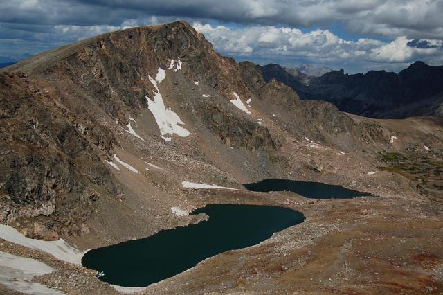
Dropping into the basin was easy enough; I descended the ridge until I found the gentlest aspect and scrambled down into the basin on packed but steep scree. My right knee, which I had thought mostly recovered from injuring it a month prior, started aching from my continued abuse on my descent. I made my way through the boulders in the basin and descended into the valley. While still a mile from the trail, I saw another solo hiker following the North Fork Middle Boulder Creek into the basin I had just departed.
The final half-mile to the trail turned into an unpleasant bushwack below timberline before finally dumping me onto the Arapaho Pass Trail. From there, my route back to the trailhead was easy and obvious. It started raining as I descended to my car and kept raining most of my way back home.
