Elk Tooth
Started: 2015-09-27 21:37:25
Submitted: 2015-09-27 22:40:10
Visibility: World-readable
22 August 2015: In which the intrepid narrator climbs an obscure twelve-thousand-foot peak bordering the local wilderness areas
While hiking and climbing in the southern reaches of Wild Basin last year, I finally caught a glimpse of the ridgeline separating Indian Peaks Wilderness (and the Middle St. Vrain Creek drainage) from Rocky Mountain National Park (and the Cony Creek drainage, feeding the North St. Vrain Creek). The ridge ends at the Continental Divide at Ogalalla Peak (one of the top ten highest points in Indian Peaks Wilderness -- so it's still on my todo list, despite the long approaches), and along the way its intermediate high point is a mountain named Elk Tooth, a rugged twelve-thousand-foot peak overlooking both wilderness areas.
(On some old maps the border between the national forest -- from which the wilderness area was created -- and the national park is a straight line defined by the border between T2N (township 2 north) and T3N (township 3 north) -- roughly twelve miles north of the local baseline, at about 40° north. This reflects the original boundary of the park, and of the wilderness, before it was adjusted (I believe in the 1970s) so that the administrative boundary followed the natural boundary on the ridgeline. The little strip of land that was formerly National Forest wilderness kept its wilderness status inside the National Park. The Park Service administered the majority of the park as de-facto wilderness until almost all of the park not touched by roads was finally declared a de-jure wilderness by Congress several years ago.)
I set out to climb Elk Tooth on Saturday morning, 22 August 2015. I hoped that I might be able to shorten my hike by driving up the Middle St. Vrain Road, but it was unclear from what data I could gather on the Internet as to whether I should be able to make it with my stock all-wheel-drive Rav4 (though, to be fair to the Internet, the signs were not encouraging). I drove up to the first feature in the four-wheel-drive road, which had been built to emulate the toughest feature on the road, and decided that I did not want to drive my vehicle across it, so I parked in the adjacent parking lot and prepared for a long hike up the valley.
The trail crossed to the north side of the creek and spent the next several miles heading west up the gentle valley. The four-wheel-drive road stayed on the south side of the creek; I didn't hear any traffic as I hiked. After several miles the trail rejoined the stub of the road, and I occasionally saw some people on the trail before the trail entered the wilderness as it continued its march westward up the valley.
I saw only one person on the trail in the wilderness, a trail runner who was running down as I hiked up, who told me that she had seen a mountain lion on the trail. I kept an eye out for any big cats but did saw only a large footprint in the fresh mud on the trail.


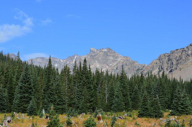
As the trail climbed the forest gradually thinned, giving way to broad meadows filled with wildflowers. I left the trail shortly before it reached Gibraltar Lake, at the base of a large gully in the ridgeline to the north, and picked my way around house-sized boulders to reach the south-facing slope. I quickly realized the gully was filled with loose scree resting at roughly the angle of repose -- for every step I took forward I would slide back roughly a step, because the rock didn't provide any useful support at all. I used my poles to distribute my weight and tried to pick my way up the mountain, but even the larger microwave-sized rocks were not stable, and I had no real desire to surf down the gully on a rock of any size.

After an interminable struggle weaving my way up more than a thousand vertical feet of scree, at length I reached the top of the gully, on a small saddle on the narrow ridge. Here I was surprised to see the first person I'd seen for hours -- another solo hiker resting in between some boulders.

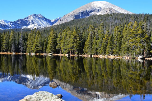
From the top of the gully my route took a sharp turn to the left, to follow the ridge to the summit of the mountain. The ridge was a fun easy class 3 scramble for another 700 vertical feet to the summit. I could see the national park to my north -- with Mount Copeland across the valley, and other summits around Wild Basin. To the south was the wilderness area I'd spent much of the day in, with Mount Audubon clearly visible in the hazy distance. I paid special attention to the head of the valley I'd climbed: the twin St. Vrain Glaciers, and the patterns of moraines and tarns and cliffs the glaciers had left as they receded up the valley.

I signed the summit register and saw that two other people had already been up here today -- presumably including the hiker I'd seen on the saddle. I ate lunch, enjoyed the scenery, and began my descent back along the route I'd ascended.

I missed my turn to descend the gully back to the valley floor and found myself on the top of a cliff I didn't remember climbing. I checked my GPS to see if I ought to try to bypass the cliff by down-climbing to the north side of the ridge, as I had done on several other tricky spots on the ridge, but my GPS track told me that I had missed my turn. I backtracked up the cliff, back across the saddle, and began my descent down the scree-filled gully. The descent proved to be far easier than the ascent; I could simply step forward, and as long as I maintained my balance, the scree would slide in front of me. At least gravity and I agreed as to which direction I ought to be going.
I rejoined the trail at the base of the gully and began the long trek back to the trailhead, happy to have spent a day in the wilderness.
