Muir Woods
Started: 2018-07-20 08:30:14
Submitted: 2018-07-20 11:43:40
Visibility: World-readable
In which the intrepid narrator visits a nearby national monument and a historic lighthouse perched above the ocean
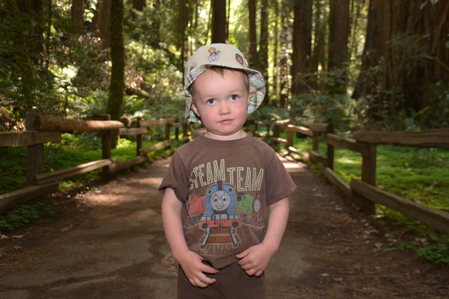
On Memorial Day, we visited Muir Woods National Monument, one of the things on my todo list before leaving San Francisco.
After moving to San Francisco, we had tried to visit Muir Woods on two prior occasions, but the parking lots were full so we redirected to other hikes in the vicinity. The Park Service recognized this as a problem and created a parking reservation system, guaranteeing a spot if one planned in advance. I reserved in advance, and there was space for us in the parking lot when we arrived.
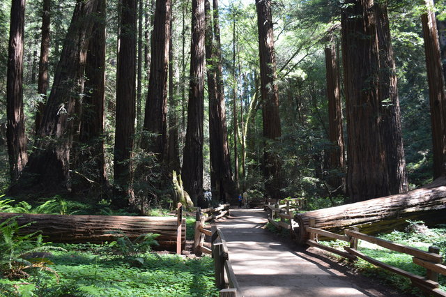
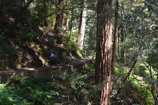
We entered the national monument, gaped at the massive redwood trees towering above the valley floor, and took a side trail that climbed onto the hillside. Redwood trees clung to the lower portion of the hillside, but as we climbed I could see where the redwoods gave way to the scrub that dominated the coastal hillsides of Marin County. It was a little weird to see the interface between these ecosystems: one cold and wet, and one hot and dry, separated only by an accident of topography.
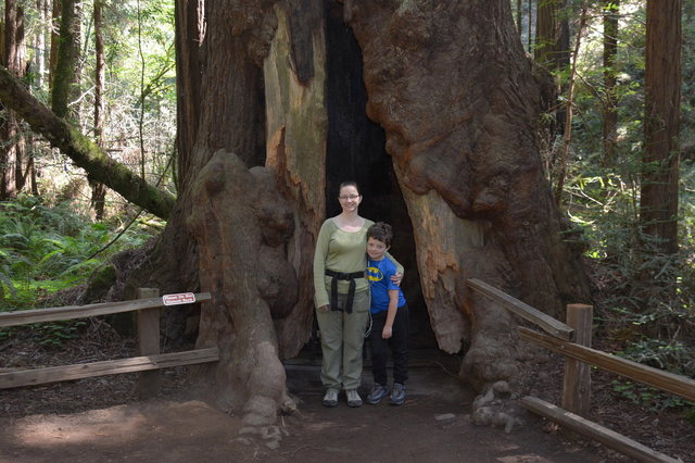
The trail led us back to the valley floor and we looped around to return to the visitor's center where we entered the grove. The trail meandered through the redwood groves, and I could see the family circles where redwood trees had grown up around the stump of an older tree. (Unlike the Forest of Nisene Marks, where the parent trees had been logged, and their stumps were generally visible above ground, the trees in Muir Woods were old growth, and the parent trees had died of natural causes.)
Walking through the towering redwood trees, with the sun filtering gently down to the forest floor, was an amazing experience.
I was impressed by the annotated cross-section of a redwood tree, showing all of the annual growth lines going back 1250 years to when the tree was a seedling, marking off events in human history when the tree was already tall.
At the gift shop, Kiesa got me a plush banana slug, probably because I'd spent most of our hike near Santa Cruz two days earlier looking for banana slugs. This turned out to be a secret stretch goal on my todo list that I'd never actually gotten around to writing down -- and because Kiesa got it for me I could keep it for myself: I didn't have to pretend it was for my children.
We left the national monument and drove to Conzelman Road, leading up the ridge overlooking the Golden Gate Bridge. The first several kilometers were mobbed by tourists vying for the impressive view of the world's most beautiful bridge with the city of san Francisco as the backdrop. The tourist traffic subsided after the turn-around at the top of the hill, at which point the road became one-way in the direction we were going. We stopped for lunch at one of the batteries on the hill, overlooking the Golden Gate in the bright mid-day sun.
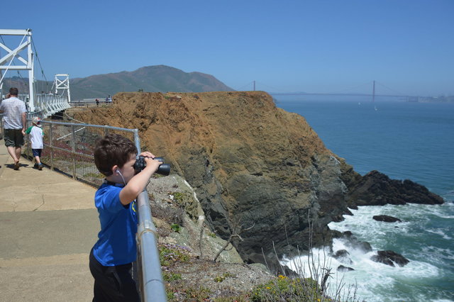
We drove towards Point Bonita, parked, and walked down the hill to the Point Bonita Lighthouse, perched on a rock guarding the northern approach to the Golden Gate (and occupying its own spot on my todo list). With my binoculars I could see pelicans and cormorants on the narrow beaches below the rocks, and harbor seals hauled out on the beaches facing eastward, sheltered from the force of the ocean waves.
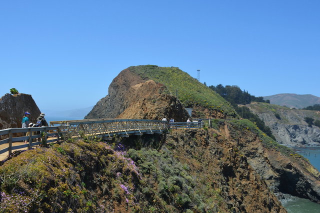
The final approach to the lighthouse was a rickety suspension bridge suitable only for foot traffic, suspended precariously above a spit of land connecting the lighthouse to the mainland. The bridge swayed as I hurried across it, trying not to look at the waves breaking on the rocks at the base of the cliffs below me.
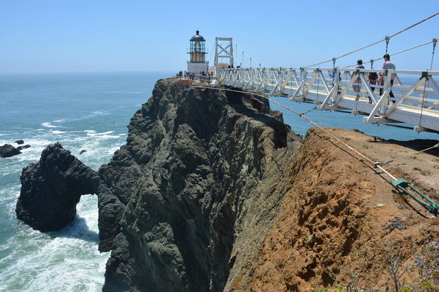
The lighthouse continues to operate as part of the United States' marine navigation system, though commercial traffic is guided by GPS more than lighthouses. The lighthouse was on, shining its light through the bright mid-day sun, barely visible under the light.

I looked around the exhibits inside the lighthouse, including a large map of all of the shipwrecks in front of the Golden Gate, and posters of the wildlife visible from the point. From the deck around the lighthouse I could watch the marine traffic go in and out of the Golden Gate, a mixture of giant container ships and sail boats and fishing boats enjoying the holiday. The day was hazy, thwarting my attempts at scenic pictures, but it was perfect for seeing one more amazing place in the Bay Area before I leave.