Johnston Ridge
Started: 2019-09-29 14:24:13
Submitted: 2019-10-03 00:06:23
Visibility: World-readable
In which the intrepid narrator ascends Johnston Ridge to look down the throat of Mount St. Helens' 1980 crater
I climbed Mount St. Helens in 2011, via the standard Monitor Ridge route, ascending the mountain via the still-intact southern ridge. Only when we reached the crater rim, after hours of climbing, did we have any direct indication that the mountain had violently erupted in 1980, cutting off thousands of feet of mountain, leaving a smoking crater where a new lava dome builds itself, reminding us that the volcano is very much still active and portending a new eruption sometime in the future.
Since moving to Seattle last year the closest I've gotten to the famous volcano is flying over it on my way south. When I fly to the Bay Area I can reliably sit on the left side of the plane and see the Cascade volcanos lined up guiding my path south -- as long as the clouds (or, occasionally, the wildfire haze) cooperate; when I fly to southern California or the Central Valley the air traffic routes tend to take me east of the Cascades, so my optimal strategy is to sit on the other side of the plane.
I never managed to visit the Johnston Ridge Observatory on the ridge overlooking the crater, the centerpiece of the Mount St. Helens National Volcanic Monument. It's a three-hour drive, one-way, from Seattle, so it's basically out of the reach of any credible day-trip, and there are few cities of reasonable size anywhere near the monument so it's hard to set up a credible overnight trip. With summer drawing to a close, and our future in Washington uncertain, we undertook a weekend trip to Mount St. Helens on my birthday.
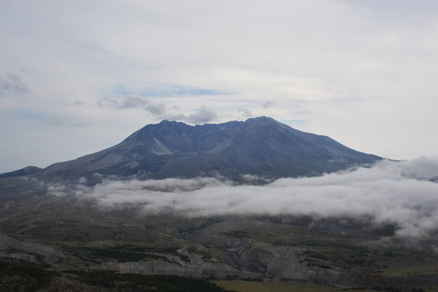
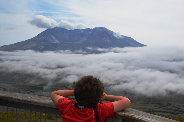
We drove to Johnston Ridge on Saturday morning. I was worried about the weather: the forecast called for partial clouds but was ambiguous about where the clouds would be or whether we could actually see the mountain. As we drove up the winding mountain road leading to the observatory, through tall forests and recently-logged land, a light rain fell from a cloudy sky; as we climbed we climbed through the clouds and emerged in a layer between the clouds: fog clung to the valley below and hung above the summit. We stopped at a convenient overlook and gazed at the volcanic crater, framed between the layers of clouds (but awkwardly backlit in the haze).
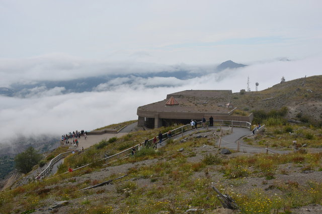
We ate a picnic lunch in the parking lot, then visited the volcanic observatory and visitor's center, a stark 1990s concrete monolith built to blend into the hillside.

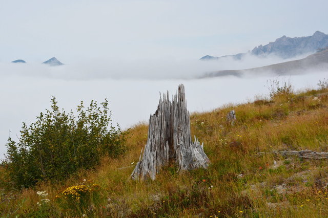
From the ridge we could see into the Toutle River valley and look up the throat of the 1980 crater where the massive volcanic eruption swept into the valley, covering it in rock, completely obliterating everything that was there before. At the top of the ridge we were standing at the edge of the second zone of destruction, where the forest was blown away by the force of the eruption but the stumps remained. The visitor's center featured a large 3D scale map of the mountain, showing how the volcano erupted and how the landscape was changed.
I lent Calvin my binoculars and he spent a considerable amount of time studying the mountain. It was not at all obvious to me what he was looking at, but he seemed to be enjoying himself, as we walked along the short trail that led up the ridge from the visitor's center.
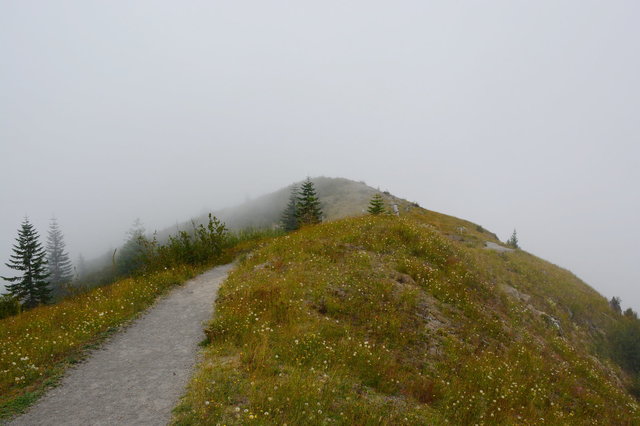
The visitor's center was perched at the end of the access road, on highest point on the ridge, with a trail leading along the ridge in both directions.

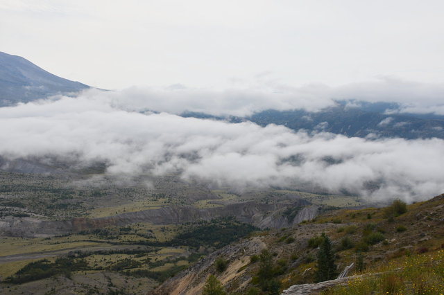
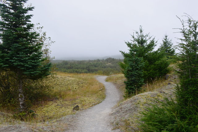
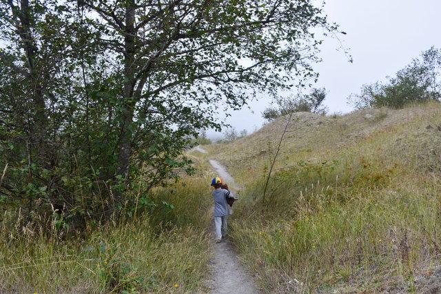
We walked east along the ridge, descending gently in the general direction of Spirit Lake, as the fog climbed up from the valley and closed in on us.
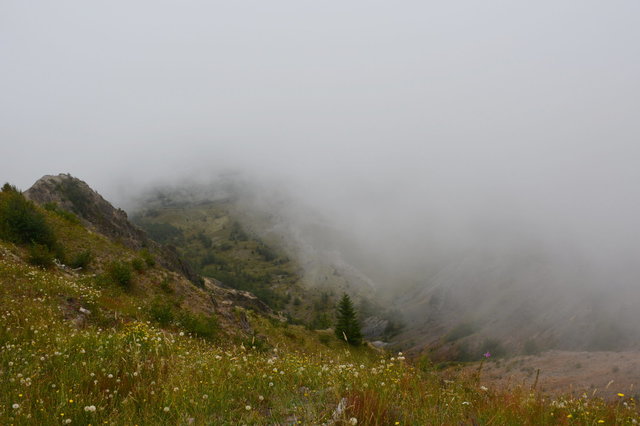
As the fog enveloped the trail, blocking my view of the volcano and the lava dome in the middle of the crater, the terrain reminded me of Colorado's alpine tundra: grass and wildflowers clinging tenaciously to steep rocky hillsides tumbling downwards into fog, with pine trees growing erratically; but the geologic forces that shaped the land were recent memory, and the pine forest would overtake the hillside again within a hundred years.
The fog enveloped us completely, obscuring our view of the mountain, and we turned back to drive to the Hummocks Trail, further down the ridge in an area where rock debris from the eruption had settled into weird conical hills fifty or a hundred meters tall. Inside the visitor's center interpretive signs explained that the eruption of Mount St. Helens had solved the geological mystery of how these hummocks were formed: similar hummocks can be found around major volcanos elsewhere in the world but their origin was unclear until this eruption. (I couldn't help but wonder how many geologists and other scientists got their PhDs studying this mountain over the last four decades.)
The scenery in the hummocks was weird: in places the rock trapped water and formed pools that supported large deciduous trees; elsewhere the porous volcanic rock only supported a thin layer of moss and some scraggly grass.

The trail wound through the mounds of rock and brought us to an overlook of the Toutle River, forever altered by the geologic forces of the eruption nearly forty years ago
As we completed the loop hike around the Hummocks Trail, the clouds grew heavy and I heard thunder in the distance portending coming rain.
We returned to the car as the rain began to fall, then drove down the mountain to spend the night at a hotel in Chehalis before driving back to Seattle on Sunday. I'd walked on the ground devastated by a volcanic eruption the year I was born, and I could mark one more thing off my todo list.
