Dumbarton Castle
Started: 2024-08-30 22:57:04
Submitted: 2024-08-31 23:33:00
Visibility: World-readable
Seeing the original Dumbarton in Scotland; also a cruise on Loch Lomond, and biking along the loch
When I first made my travel plans to attend Worldcon in Glasgow, I had the vague idea that I would stick around Glasgow for one day after Worldcon, then head somewhere else in Scotland for a few days, so I took advantage of the convention's hotel rate to reserve a room at the Grand Central Hotel at Glasgow Central railway station for the duration of the convention. I couldn't decide where else in Scotland I wanted to visit for a few days, so I decided I'd stay in Glasgow as my base of operations and make excursions from there, before taking the train to London on Friday. But by the time I got around to asking my hotel if they had space to extend my stay by two days it turned out they didn't (at least, not in the mini-suite I was staying in, with a separate tiny sitting room with a comfortable armchair in front of a little table lit by a dim light fixture that made it hard to read), so I booked another two days at a different hotel a few blocks away in central Glasgow. This meant I had to pack my suitcases and check out of my hotel, then drop my suitcases at the left luggage storefront in Glasgow Central, before taking the train to Loch Lomond for the day.

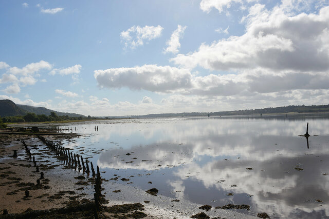
I walked to Glasgow Queen Street station and caught a suburban train heading west along the north side of the Clyde to Dumbarton East. I stopped at Dumbarton in part because it shares a name with a bridge back home in the Bay Area, and also because there's a legitimately-interesting tourist site at Dumbarton Castle, a short walk from the station, off the high street along a road lined with detached tract houses built in the last twenty years. At the end of the subdivision, under the volcanic plug climbing precipitously above the low ground just above the high-water line on the Clyde estuary, I found the local football club's stadium (which was, on the Wednesday morning, being used as a motorcycle school). Google Maps routed me into the car park in front of the football pitch because it doesn't always understand that when I want directions to a place I want to enter via the front gate (wherever that happens to be) rather than the road that happens to be nearest to wherever it thinks the marker is supposed to be. I course-corrected and found the real front gate further down the road, above the mud flats of the Clyde estuary, stretching all the way back to Glasgow.
I paid to enter the historic site and began my depth-first search of the paths on the hill. (The map, and the cashier at the entrance, both advised me that all of the paths were dead-end paths so it was hard to get lost; but also that I should pay attention so that I visited everything, which I interpreted as a depth-first graph traversal.) I took the left-most path first, which turned out to be a narrow walkway on the inside of a neat stone wall leading along the edge of the hill, just above the river to Bower Battery, one of the many places where various canons had been placed while it was a military fort.
The path dead-ended at Bower Battery, with a view of the Clyde and its junction with the river Leven. I walked back along the wall and turned into the interior of the hill, following the path under the Guard House and then looping back to climb the stairs into the one-room building, spanning the gap between rocks, effectively guarding the entrance to the higher points of the rock. Inside the guard house were some exhibits with a diorama of the rock, and a series of posters talking about the time that Mary, Queen of Scots spent at Dumbarton Castle before heading to France.
Beyond the guard house the path climbed on tidy modern stairs through a narrow cleft in the rock, passing under a dramatic stone arch (which a sign on the wall identified as "Portcullis Arch") to reach a saddle point between the two high points on either side of the rock.
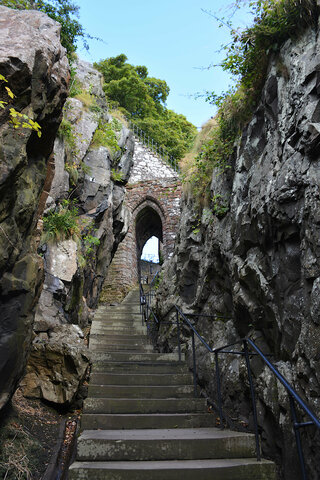
At the saddle the paths diverged again, and I took the path leading to the higher of the two summits, labeled White Tower Crag on the map displayed at the entrance gate. This route took me over the top of Portcullis Arch (just visible in the picture above is the railing protecting the sides of the narrow stairway climbing precipitously above the arch), and up a series of steps to the summit of the crag.
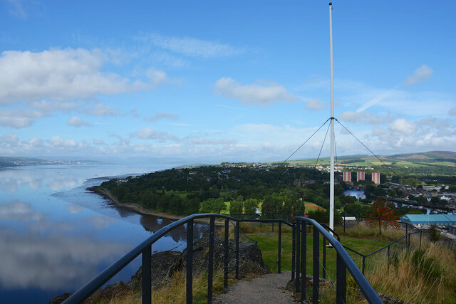
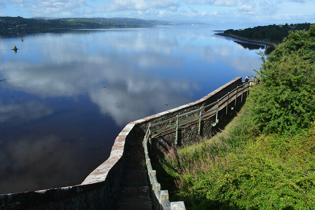
The interpretive signs at the summit, and elsewhere on the crag, indicated that various buildings had stood on the site at various points in history; the rock had been used as a fortified center of government for at least a thousand years. On my visit the summit had a fence surrounding a small grassy summit with an empty flagpole, and a peak finder pointing out the nearby mountains and other sites to the north. It was partly-cloudy (the clearest day so far in the week I had spent in Scotland, which was why I picked this day to head towards Loch Lomond), and I could see most of the nearby summits in the Scottish highlands. To the west the river Clyde flowed past Port Glasgow, emptying into the Firth of Clyde and eventually to the Atlantic Ocean.

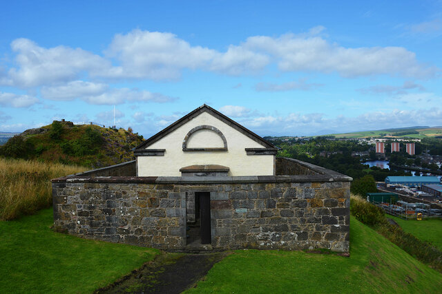
I descended to the saddle point, via the well-maintained path, and ascended to the other summit, occupied by a powder magazine, one of the few surviving structures on the rock. It was surrounded by a wall to try to contain the damage in the event of an explosion. It was open so I was able to walk inside, but it was whitewashed and empty inside and hard to imagine what it would have looked like when it was in use.
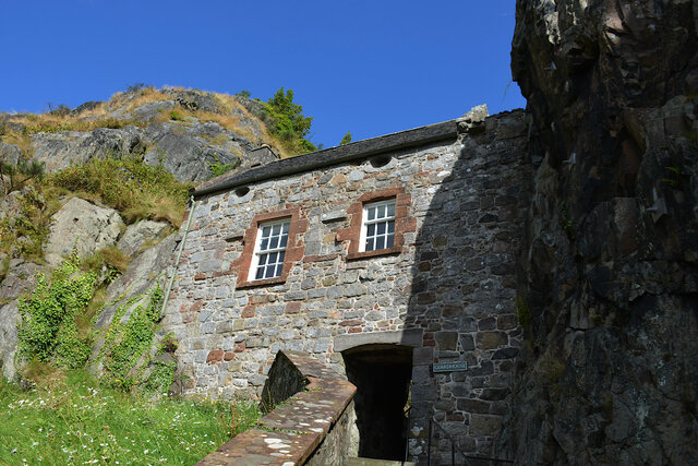
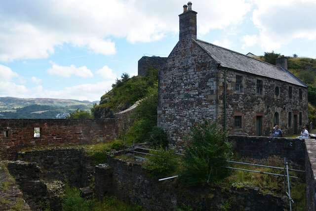
One of the surviving structures on the rock, and the last building I saw, was the French Prison, named because it was used to hold prisoners during the Napoleonic Wars. The building itself was closed for restoration (and it was clear that it had been restored because the mortar was in much better shape than I would have expected from a two-hundred-year-old building rock wall) so all I could do was look at the outside, and look down into the foundation of the ruins next to the building to try to guess how the buildings on the rock would have been used while the prison was in use, or at any point in the thousand-plus-year history of the fortifications on the hill.
I descended the hill and headed back to the train station to catch the next train the rest of the way to Balloch. There were two trains per hour, which gave me enough time to drop by a tiny grocery store down the street from the station to pick up a sandwich for lunch to eat on the train.
From Dumbarton the train diverged from the main line heading towards Fort George and the rest of the western highlands and headed up the valley carrying the river Leven as it drained Loch Lomond. When the train arrived at the end of the line in Balloch, at the very southern end of Loch Lomond, I crossed the street to Sweeney's Cruise Co and bought a ticket on the 12:30 two-hour "Island Discovery" cruise. (I decided not to book anything in advance because I judged that I would rather have operational flexibility than the a guaranteed ticket at a particular time.)
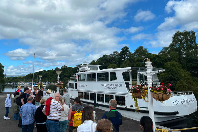
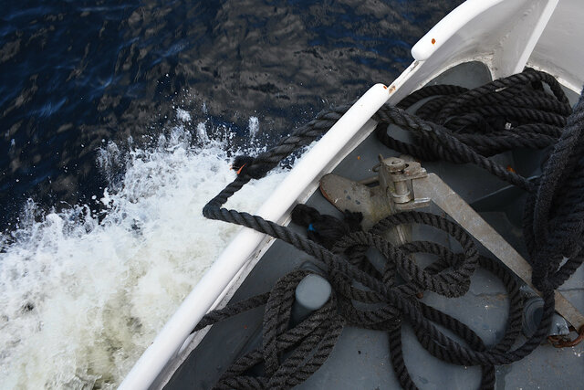
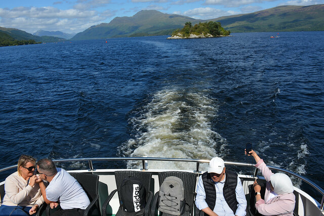
I joined the queue waiting to board the 12:30 cruise. On board the Silver Marlin I got a seat on the upper deck at a long booth with a couple of other people. When we were underway I joined the people standing on the open-air bow to get a better view of the scenery. Throughout the cruise there were some announcements on the PA describing the scenery we were passing, but for the most part I was left to my own interpretation, occasionally cross-referencing where we were and what I was seeing on Google Maps.
As the crowd shuffled on the bow I got a chance to stand at the front railing, looking out at the water in front of me and the water splashing up as the bow moved through the lake. My immediate thought was, "I'm flying, Jack, I'm flying!"
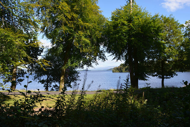
Loch Lomond is a long lake carved by glaciers on the boundary between the Scottish lowlands and highlands. We started at Balloch, on the southern end of the loch, where the loch drains via the river Leven towards the Clyde. On the water I saw a variety of other vessels, mostly personal watercraft including kayaks, paddleboards, and jetskis.

We cruised north through the lake, approaching the island Inchmurrin and cruising along its east shore where we caught the occasional glimpse of the buildings on the island as the announcement on the PA explained to us that the island had been inhabited for centuries and was now privately owned with an exclusive restaurant with a tiny dock on the shore near us.
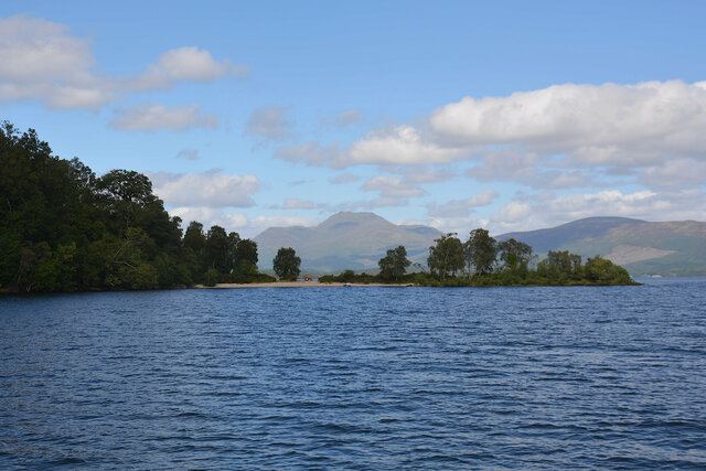
Past Inchmurrin the loch opened up to the east, reaching its widest point. We continued north, routing around the island to head to a group of islands blocking passage further north. The islands were low above the water with grassy fields reaching the water's edge, and people were camping and picnicking on the islands. As we approached the islands it was hard to tell that there was a channel separating the islands (or that the channel was deep enough so that our boat could pass), but as we approached the narrow channel between the islands of Inchtavannach and Inchconnachan began to reveal itself.
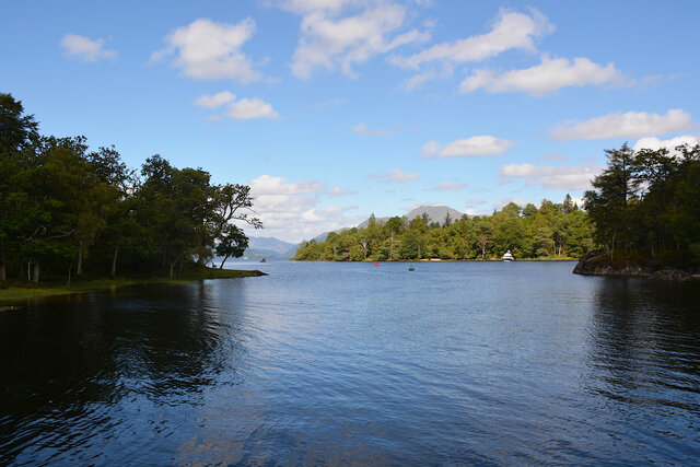
After navigating the narrow passages between the islands the water opened up again and we cruised to the town of Luss on the west shore. We had traveled barely one-third of the distance from the south of Loch Lomond to the north, and this was as far as we were going to cruise today. We docked in Luss to let some one-way passengers disembark, then pushed off to turn to the south and return to Balloch.
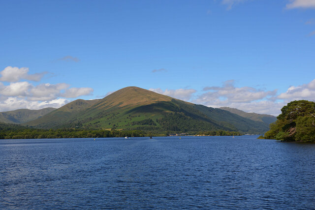
The highest mountain around the loch, visible from many of my pictures of the eastern shore of the lake (including the picture below) is Ben Lomond. Its elevation of 3,196 feet classifies it as a major peak in Scotland. The announcements on the PA pronounced "Loch Lomond" and "Ben Lomond" with a silent "d", which looks like it comes from its name in Scottish Gaelic, "Laomainn".
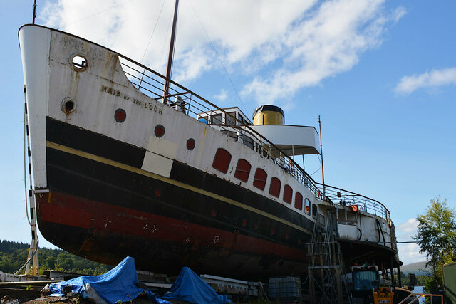
On our trip back to Balloch we stayed closer to the west shore of the loch, following a more direct route back with less navigating back and forth between islands. When we docked in Balloch after the cruise I walked back to the shore of the loch to look out myself, standing on dry land instead of on a boat moving over the surface of the water. My route took me next to the Maid of the Loch, a side-wheel paddle steamer built in 1953 for excursions on Loch Lomond — a much larger version of the ship I had just taken on my trip on the loch. The ship left commercial service in 1981 and is currently under restoration. It's open to visitors on weekends; but I visited on a Wednesday so I had to view the ship, perched awkwardly on a slip above the water allowing access to the hull for restoration.
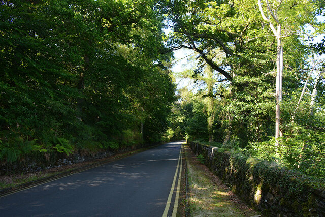
To get a bit further into the countryside around the loch I rented a bike at a shop on a beach around the corner from the Maid of the Loch, then headed out up the west side of the loch. I wasn't quite sure where I was supposed to go past the Loch Lomond Shores shopping mall, but I eventually ended up on Old Luss Road, which looked like the old highway running around the loch before the current A82 carriageway was built. (I took care to ride on the left side of the road, which felt awkward but I got used to it.) The road was poorly signed, and Google Maps had very little idea about the possibility of bike infrastructure in this part of Scotland, so I turned back on the road and nipped into the roads around the Cameron House resort, centered around Cameron Bay on the west shore of the loch. This delivered me to the main gate of the resort, around the corner from Duck Bay. I biked through the side road running along the bay, then found the poorly-marked bike path that ran along the A82.
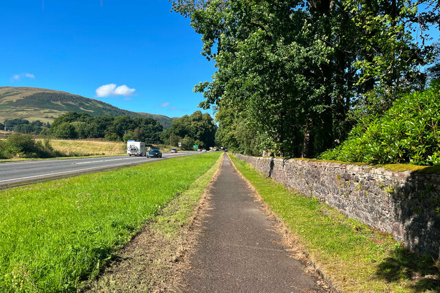
I followed this path north, along the highway, occasionally departing from the A road to cross what looked like the old route for the highway, including on a cute old bridge much smaller than the upgraded carriageway. I passed several golf courses and ended up biking most of the way to Luss before deciding that I had used approximately half of the two hours I had rented the bike for (allowing for an appropriate safety margin) and had gone far enough that I could turn around, when the bike path joined a country road somewhere I can't clearly locate on the map (but was probably around here, just north of what I think was the gate at the entrance to Rossdhu House).
Google Maps won't give me clean distances because it doesn't have all of the bike path mapped but this looks like it was something on the order of 7 miles out of Balloch.
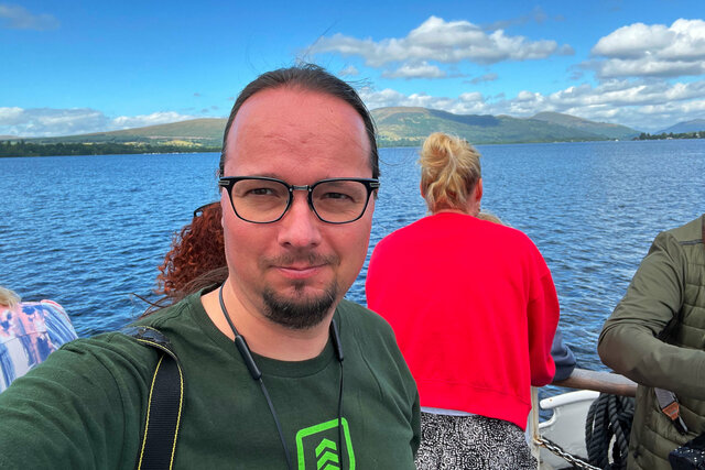
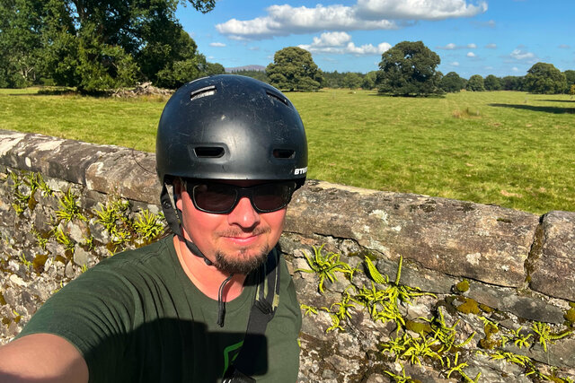
On the way back I picked the most scenic spot on the bike path along the A82, in front of a pasture that had sheep somewhere in the distance (though I don't think they appeared in the background of my picture) and took a selfie.
I followed the bike path all the way back to Balloch, past Duck Bay past the entrance to Cameron House and onto the path hugging the side of the highway. The path dropped me off at the end of Old Luss Road (which Google Maps unhelpfully indicates as the road ending nowhere; from there I found the route past Loch Lomond Shores to the awning on the beach where I had rented the bike. I dropped off the bike and walked back to the train station in time to catch the 17:08 train back to Glasgow. On the train I watched most of my employer's monthly all-hands meeting (broadcast live from the office in Santa Clara), until my train dropped into a tunnel between Patrick and Glasgow Central and I lost my cell coverage.
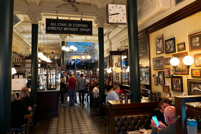
In Glasgow I picked up my bags at Glasgow Central, then checked into my new hotel a few blocks away, the ibis Styles Glasgow Centre George Square. I decided that I wanted to eat Indian for supper (because I had walked past an Indian restaurant on my way out of Balloch and I could smell the food as I passed) so I found Chaakoo Bombay Cafe, which had clearly been inspired by the same Parsi cafes in Bombay that inspired Dishoom (and had maybe also been inspired by Dishoom). I enjoyed a great dinner featuring dal, paneer skewers cooked in a tandori oven, and naan.
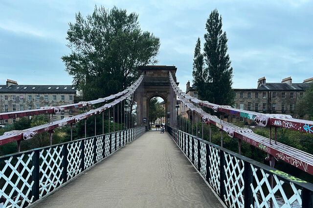
After supper I walked across the Clyde on a pedestrian suspension bridge built using cables formed from wrought iron. The interpretive sign from the Institute of Civil Engineers on the south bank was so badly graffitied that I couldn't read it, but Wikipedia tells me that the bridge was built between 1851 and 1853 and was designed by Robert Stevenson.
I returned to my hotel and made my plans for my last day in Glasgow, and bought a train ticket to leave Glasgow to head to London on Friday.
I took a bunch of pictures at Dumbarton Castle and on Loch Lomond; they're all at Photos on 2024-08-14.
