Last day of summer
Started: 2007-09-26 21:28:05
Submitted: 2007-09-26 22:02:25
Visibility: World-readable
Sunday was the equinox, signaling the end of summer in the northern hemisphere.
When I woke up Sunday morning, I contemplated what I might do on my last day of summer, my last good chance to hang out above timberline along the Continental Divide. I decided I had enough time for an ascent of James Peak, which I first discovered at the beginning of the summer and realized I could see it from Longmont. (While driving into Boulder, it's the southernmost point I can see on the Continental Divide.) James Peak crowns the eponymous wilderness, gerrymandered out of Gilpin and Clear Creek Counties. On 1 July, I drove to the East Portal of the Moffat Tunnel and hiked to Rogers Pass, less than two miles from James Peak, before turning back. This time, I drove past Idaho Springs on I-70, then turned north towards St. Mary's Glacier but headed west before reaching the snowfield to park at N39° 48.686', W105° 40.041' on a high-clearance road on the Continental Divide Trail.
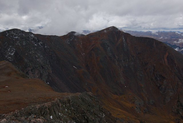
I hiked north along the Continental Divide Trail, climbing above treeline on a long ridge overlooking Loch Lomond and a collection of other small lakes. It was overcast; as I hiked I saw rain to the south, and James Peak itself was shrouded in cloud. The trail turned north-west and continued climbing James Peaks' broad east ridge. At 12,000 feet it started raining; I was already wearing my rain gear. Five hundred vertical feet later I entered the cloud; visibility dropped to fifty meters for the gentle climb (as gentle as climbs get at 13,000 feet in a rain) to the summit.

I reached the summit just as the rain cleared; the cloud ceiling remained, denying me sun, but giving me a view of Winter Park, Mount Bancroft, and Rollins Pass from the broad summit. I tried to take a self-portrait but forgot that I could adjust the timing; the last time I used the timer feature was to take long-exposure shots from a tripod. On the last day of summer, I completed a key objective for my summer excursions.
On my descent, I descended more sharply into the valley, hiking across the dam at the end of Loch Lomond to a four-wheel-drive road which took me to the Continental Divide Trail and my vehicle. It occurred to me that I could have driven all the way to the lake, although I couldn't identify whether I was sufficiently confident to navigate the road in Motoko from my map itself. (My map also identified some of the land surrounding Loch Lomond as private land within Arapaho National Forest.) My hike totaled nine miles and 3300 vertical feet in less than five hours, which is actually a bit easy by my warped standards.

