Shoshoni, Pawnee, Toll
Started: 2011-07-08 08:03:52
Submitted: 2011-07-08 09:52:10
Visibility: World-readable
On Saturday morning, 2 July, I set out to climb three of the Indian Peaks above Brainard Lake. I took advantage of the late wet spring to take a route normally already melted in early July, a snow climb up the southwest couloirs on Shoshoni Peak.
My alarm woke me up alpine-early at 04:00 on Saturday. I drove up Lefthand Canyon through the recently-burned (earlier in the week) area next to the Lefthand OHV Area. I didn't see much snow on the ground until entering the Brainard Lake Recreation Area; there was less snow around the lake than I saw over Memorial Day, and the road around the lake had been plowed, but there were still significant drifts next to the road. The lake had melted and snow still blanketed the surrounding peaks. I arrived at the lake around dawn at 05:30 and saw at least one photographer staking out a strategic spot on the eastern shore of the lake to catch the alpenglow on the peaks.
The Long Lake and Mitchell Lake trailheads were still closed, so I parked next to Brainard Lake and hiked up to the Long Lake Trailhead. A few scattered drifts still covered the road, but it wasn't so much that it couldn't easily be cleared. The reason the trailheads were still closed to vehicles was apparent as soon as I stepped past the paved parking lot onto the trail: the trail was covered in packed snow, and was occasionally difficult to find. I followed the boot pack past Long Lake and up the valley toward Lake Isabelle. The boot pack grew fainter as I ascended and eventually gave out entirely where the summer trail switchbacks up to the lake itself. In May I saw an epic cornice on the top of the headwall; now it had melted enough that I could see water rushing through.
I reached Lake Isabelle and continued west, trying to follow the general path of the summer trail as it clung to the slope above the lake. The snow was still crisp from freezing overnight, and in places where it drifted I needed my ice axe to gain enough purchase on the tough snow to cross it. I saw bootprints on the ice on the lake (possibly belonging to a coworker who ascended Queens Way the previous weekend) but the lake was melting and I wasn't willing to tempt fate. If I had to do it over again I'd consider the gentle slopes south of the lake, where more snow had melted.
I ascended the snowpacked slopes west of the lake, working my way south of Shoshoni Peak to the little lake nestled in the cirque between Shoshoni, Apache, and Navajo Peaks. While descending a gentle tundra slope to reach the lake I tripped, fell, and caught myself with my left hand. My hand hurt more than I expected; I gingerly peeled off my glove to see only the top layer of skin broken. I didn't think I'd injured it worse than a nasty bruise and pressed on. (The bruise arrived a few days later, often encompassing the entire heel of my hand, the base of my thumb, and stretching into my wrist. I had trouble getting enough grasping strength to open jars with my left hand for a day or two, perhaps exacerbated by my recently-healed broken left index finger.)
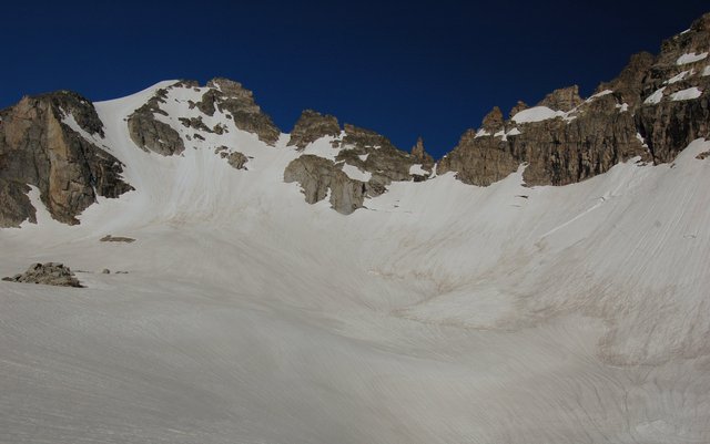
I picked my way around the boulders on the north side of the unnamed lake and I ascended toward Isabelle Glacier. I could follow the summer trail for a few switchbacks until the trail disappeared under a large snowfield. I ascended the snowfield directly and stopped above the tarn at the end of the glacier. This was my first good chance to preview my route: a couloir inset into the southwest face of Shoshoni Peak. As I expected, the couloir was still filled with snow; in fact, the entire basin had far more snow than rock. It seemed like the summer snowmelt was a month late. I donned my crampons and headed for my climb up the center couloir, climbing straight north to a dramatic exit right on the Continental Divide.
The climb started on a crisp layer of melted and refrozen slush, which gave me excellent purchase for my boots (to the point where I may not have really needed crampons, though my boots are a little underspeced for proper winter mountaineering, lacking a proper hard plastic toe and sole for kicking steps) but occasionally swallowed my ice axe whole. I began my ascent at 08:30, well after sunrise but still well before the south-facing couloir, well shaded by the bulk of Shoshoni, saw any direct sunlight. As I climbed the one thing I noticed was how quiet it was: the only thing I could hear was my own breath: no wind, no water, no other people.
The couloir grew steeper around the midpoint and the snow remained frozen slush. I stepped over snowbridges over a pair of deep bergschrunds. At the two-thirds point of the climb I could see my exit, bathed in mid-morning light. Before starting the climb I could see that the cornices had melted, but as I got closer I got the opportunity to survey my exit more directly. I picked a line to the shallowest part of the ridge and climbed the last fifty vertical feet in the sunny, melting, steepening near-slush. When I climbed the false summit the couloir had one more surprise: another one-meter vertical step I had to climb before I could stagger the last horizontal ten meters to the edge of the snowfield.
Still winded from my climb, I removed my crampons, stowed them in my pack, and looked up at the mountains beyond. I could see Lake Granby and my campground from a month ago, jutting out on a peninsula into the reservoir; as well as the snow-covered Indian Peaks, Rocky Mountain National Park, and the Never Summer Mountains. Off in the distance to the north-west I could see the mountains including Mount Zirkel above Steamboat Springs. Apache and Navajo Peaks obscured my view of the Gore Range and the southern Indian Peaks, but I saw those later.
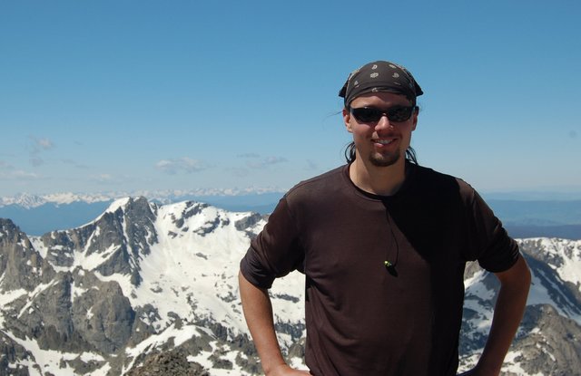
I scampered across the ridge to Shoshoni Peak and reveled in the glory of the summit for a few minutes before descending to the ridge and beginning the traverse north to Pawnee Peak. Just above the ridgeline I saw a rounded snow-capped summit that looked more like Mount Hood than anything I expected to see in Colorado. As I approached I could see that it was just a drift accumulated on a minor high point on the divide above Pawnee Pass. I ascended two unranked summits and descended to Pawnee Pass. This was the first time I'd crossed Pawnee Pass since my summer 2008 backpacking trip with Kiesa, and this time the pass was the low point on my ridge traverse rather than the high point on the trail. I climbed the last few hundred feet over gentle tundra to Pawnee Peak. Here I got a better view of Niwot Ridge and the southern Indian Peaks, and I could look down the adjacent valley to see skiers ascending the vast snowfield on the south side of Mount Toll. (I recall climbing Pawnee Peak once before, sometime in the early 1990s, as my father trained me to climb mountains culminating in an ascent of Mount Sherman.) I ate lunch, fought back low-blood-sugar fatigue, and presently descended the north slopes of Pawnee Peak and ascended toward Mount Toll. When I reached the snowfield I put on my crampons and began my final ascent. Before I entered the snowfield a group of six skiers descended (the first people I'd seen in hours), and as I climbed a pair of skiers took advantage of my kicked steps to follow.
I reached the summit a little after 11:00 and quickly surveyed the western sky to double-check the weather. Nothing seemed at all ominous, so I snacked, searched unsuccessfully for a summit register, and talked to the skiers who ascended behind me. They were a father-daughter pair, and the daughter had convinced her father to carry her skis on his pack while he climbed using crampon-riser contraptions strapped to his boots, allowing him to climb straight up moderate snow slopes like the one we were on. (I caught myself taking notes about the people I saw, cognizant of the father-daughter pair of climbers missing on Missouri Mountain. They were still missing at the time of my climb but were later found dead, having apparently fallen on their descent, though publically-available details remain sketchy. No similar fate befell anyone in the Indian Peaks while I was there. Inspired by their fate, I carried a brand-new 406 MHz personal locator beacon that broadcasts a distress call to a public network of satellites.)
I descended the broad snowfield on the south side of Mount Toll at 11:30 and found soft snow all the way to Blue Lake, 1500 vertical feet below. At Blue Lake I reapplied sunscreen, took off my crampons, and scrambled over the rocks and snow until I found something that resembled the trail. (As soon as I set foot on the trail I promptly slipped on the mud, proving that trails are more dangerous than snowfields.) I followed the trail the best I could through the deep snow. As I approached Mitchell Lake I saw day-trippers in sneakers and shorts and wondered if they realized or cared how underspeced their gear was. (I was still wearing my boots, long pants, and gaiters, and carried my ice axe for extra balance as needed; I'd stowed my crampons and climbing helmet.) The deep snow persisted all the way to the Mitchell Lake Trailhead. I walked down the closed, occasionally-drifted road the last half-mile to my car, arriving early afternoon, and actually beating Kiesa and Calvin home.
In one fell swoop I completed three high ranked twelvers, and saw for myself just how much snow there is in the Indian Peaks. That counts as a good day.

