Lobos
Started: 2018-07-31 22:01:56
Submitted: 2018-08-01 00:02:20
Visibility: World-readable
17 June 2018: In which the intrepid narrator travels south along California Highway One towards Big Sur
As our last adventure before leaving California, I staged a week-long family road trip to the central California coast, visiting Big Sur and Monterey.
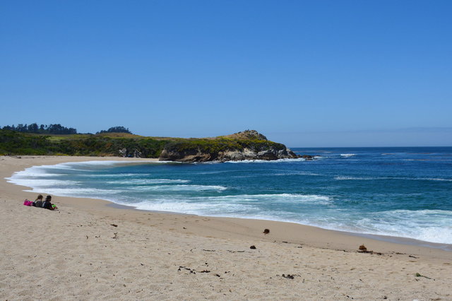
We departed San Francisco on Sunday, 17 June and took the inland route to Monterey, driving down I-280 to US-101 through Gilroy, then diverging US-101 to continue westward though the mouth of the Salinas Valley to Monterey, where we drove along dunes the dunes that lined the coast until we reached Monterey. We kept driving, along California state highway 1 to Point Lobos; then turned around and stopped a few kilometers away at Monastery Beach. We set out our beach blanket (newly issued as schwag from my employer, which actually turned out to be useful) and ate lunch on the beach, among signs warning about dangerous rip currents on the steep beach.
(Along the way I learned from my brother Willy that he had received a job offer as a history professor at Pacific Union College in Angwin (somewhere vaguely north of Napa) -- so he will be moving from Washington to California shortly after I move from California to Washington. I'm disappointed that I won't be around while he's in California, but at least I have a better excuse to come back.)
We drove closer to Point Lobos, parked outside the gate, and walked inside the preserve. Signs warned about poison oak, so I made sure to point out to Calvin which plants he definitely shouldn't touch, and Kiesa tried to keep Julian away from any vegetation encroaching on the side of the trails. We walked to the whaling station overlooking a tiny cove, where we saw giant whale bones strewn about, a few large sections of baleen, and various whaling artifacts inside the little shed. The site was once used by shore-based whalers who would capture whales in the ocean off the coast and tow them to this cove to extract their blubber for whale oil.
We looked around the adjacent cottage, which held artifacts from the fisheries and canning industry that dominated Monterey for a century, including a large and clunky (and falling apart) diving suit used to scrape abalone shells off the rocks and into baskets to be canned in Monterey. The exhibit included a silicone model of the marine mollusk living inside an abalone shell, which did not look at all appetizing.

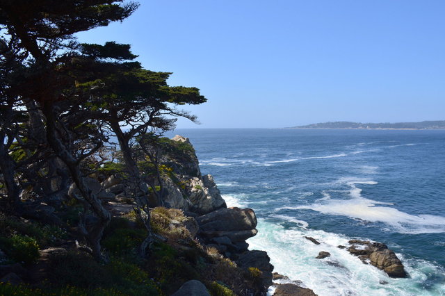
We continued our circuit of Point Lobos, following the trail along the rocky bluffs towering above the Pacific Ocean, where scraggly pine trees clung to the bleached granite above waves breaking in a white froth in azure water. As we approached the end of the point the pine trees grew taller and more stately as we entered the last remaining native grove of Monterey Pines, clinging to the rocks above the ocean.
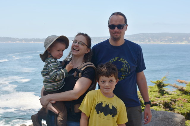
We rendezvoused with Echo, our former au pair, now living somewhere in Orange County and working as a software engineer, who drove up to meet us on our last road trip in California.

I got Echo to take a family picture of us, which probably turned out about as good as we could wish for. (I am not convinced we can use this picture with a straight face in Washington, since I'm convinced that everyone in Washington would recognize this as a picture taken in California and think less of us; but Kiesa thinks I'm being paranoid and Washingtonians will merely think it's a nice scene by the ocean, and of course Washington has ocean, though it's not usually quite so sunny.)
We walked the rest of the way around Point Lobos, through the grove of Monterey Pines, and past sea lions barking at each other on the beaches far below. (The point apparently got its Spanish name -- "lobos" for wolves -- because the Spanish explorers thought the sea lions sounded like wolves.)

We headed back to the car, and on our way out of the park Calvin very deliberately and intentionally touched a branch of poison oak (apparently on the theory that he was not touching it accidentally or something), so we sent him immediately to the (suspiciously-convenient) restroom to wash his hands, with soap, before he could touch anything (or anyone) else and spread the hateful oil.

We continued driving down California Highway One, with Echo following in her car. The road took us through the expensive houses dotting the coastline in the Carmel Highlands (at least one of which looked like a castle, though I couldn't really tell since I was driving), and into Big Sur. Here the coastline grew more rugged, with scrub-covered hillsides climbing hundreds of feet immediately above the water. The highway clung tenaciously to the hillside, occasionally giving way to a viaduct where the dirt below slid away leaving only open air. (On our visit the highway south of Big Sur was still closed, as it had been for more than a year, after a giant mud slide inundated several kilometers of road.)

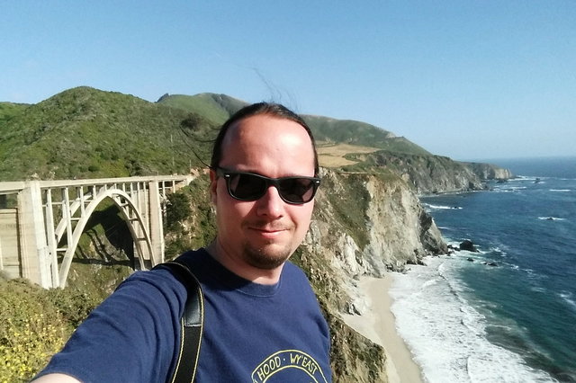
We stopped at a viewpoint overlooking the Bixby Creek Bridge, a magnificent concrete arch bridge spanning an impressive canyon over a tiny creek far below. Julian had fallen asleep in the car, so I took Calvin out of the car to observe the bridge -- and the crowds of tourists (like myself) who were admiring the monument to civil engineering and the rugged beauty of the central California coast.
We continued southward and stopped at the overlook for the Point Sur Lighthouse, which eluded my aspiration of photography due to poor late afternoon lighting, then resumed our journey southward to the Big Sur Lodge at Pfeiffer Big Sur State Park. We checked into the lodge, where we would be staying for two nights, then ate supper at the lodge before retiring for the night. (As a late addition to our group, Echo ended up finding lodging back in Monterey, so she had to drive back for the night.)
I have a few more pictures from our drive to Big Sur at Photos on 2018-06-17.
