When it rains in the desert
Started: 2017-02-26 15:58:09
Submitted: 2017-03-02 22:28:36
Visibility: World-readable
14 February 2017: In which the intrepid narrator visits craters, dunes, and canyons in Death Valley; and contemplates the impact of water on shaping the desert landscape
I woke in my campsite at Furnace Creek Campground in Death Valley National Park rested and recovered from dehydrating myself the previous day. I filled my Camelbak and carried it with me everywhere I went to keep from repeating the previous day's experience.
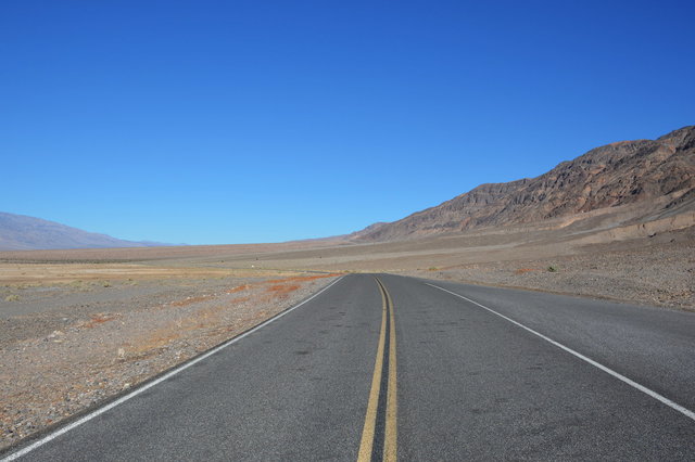
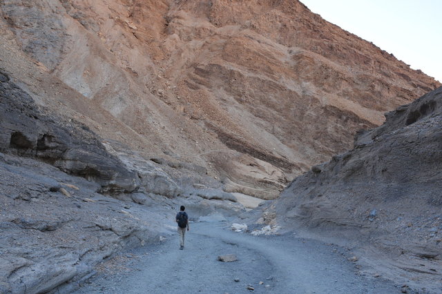
After breakfast, Willy and I set out to drive to Ubehebe Crater, on the northern side of Death Valley. As we drove north, through Death Valley, gradually climbing above sea level through the flat barren landscape, the salt flats below sea level gave way to scrub over alluvial deposits, bordered by rugged mountains on either side of the valley.
I was fascinated by the impact of water on the terrain, even in this dry and barren landscape. Massive alluvial fans, thousands of feet wide and hundreds of feet high, spread out from canyon mouths, and everywhere the ground was covered in what I recognized as alluvial deposits: football-sized rocks resting on top of smaller rocks, resting where they were deposited by water in the last flood -- which could have been years or centuries ago. (I've seen this in the alluvial fan in Rocky Mountain National Park, and in the aftermath of Boulder's flooding in 2013.) The only difference from other landscapes was that here in Death Valley water was the only force shaping the landscape: there was scant vegetation to reshape the landscape or to obscure the alluvial deposits, and very little reason for humans to alter the landscape for our own purposes.
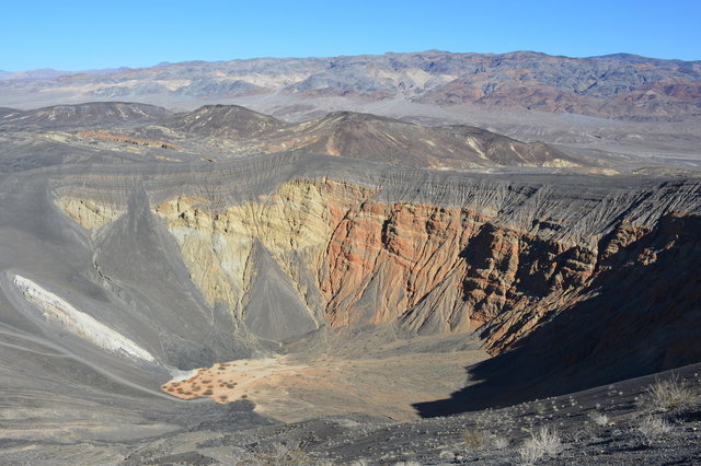
We reached Ubehebe Crater and parked on the paved parking lot perched right on the crater rim, giving us a commanding view of the rock and ash inside the crater without having to work for it. The crater had been formed by volcanic activity, carving out a crater through the rocks and throwing up ash on the landscape. We climbed around the rim of the crater, where deep furrows had been carved by water running down the edge, while the ground itself was surprisingly stable. I wondered how old the furrows were; given the lack of water in the desert landscape they could be centuries old.

Our next stop was the Stovepipe Wells dune field, back on the main road next to the settlement of Stovepipe Wells. This dune, and the settlement, was named for the well that had been dug in the valley to provide water for travelers. The wind would pile sand around the well, inspiring someone to put an old stovepipe in the well to serve as a marker.
We ate lunch at the parking lot overlooking the dunes, then walked into the dunes themselves. According to a book Willy found in the visitor center gift shop the day before, this dune had been used to film pick-up shots on Tattoine's dune fields in Episode IV, including the miniature sand-crawler crawling over the edge of the sand.
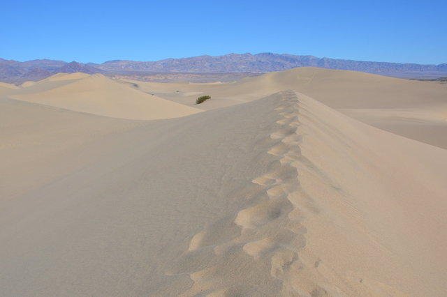
We climbed to the top of the star dune in the middle of the dune field, then returned to the parking lot by a course that was somewhat more roundabout but (in theory) followed the contour lines better, requiring less climbing straight up and straight down the sides of the dunes.
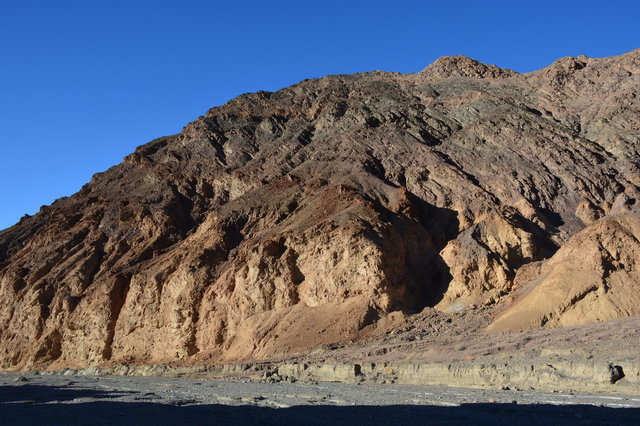
Our next stop was Mosaic Canyon, a narrow canyon carved out of the mountains of the Panamint Range close to Stovepipe Wells. Like the other canyons in the valley, it emptied onto a giant alluvial fan of rocks, sand, and dirt that had been washed down the canyon and deposited in the valley over millenia.
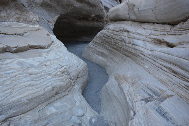
The canyon itself was narrow and dry, but the force of the water was visible everywhere. In some places the water had carved through marble, polishing it smooth; in others the rock was a rough conglomerate itself made up of alluvial deposits from an earlier epoch. The canyon wound its way into the mountain, twisting and turning as it climbed. We encountered one dry waterfall that required a quick scramble to climb over, and two more dry waterfalls that required a detour on trails carved up the rocky side of the canyon. The trail terminated at a large dry waterfall, hinting at more canyon if only we could somehow climb the cliff.

This was my favorite place to visit in Death Valley: an ever-changing landscape of various assorted rocks, sheltered from the desert sun. The salt flats and dry lake beds below sea level were surreal and bizarre; but this was a landscape I actually liked.
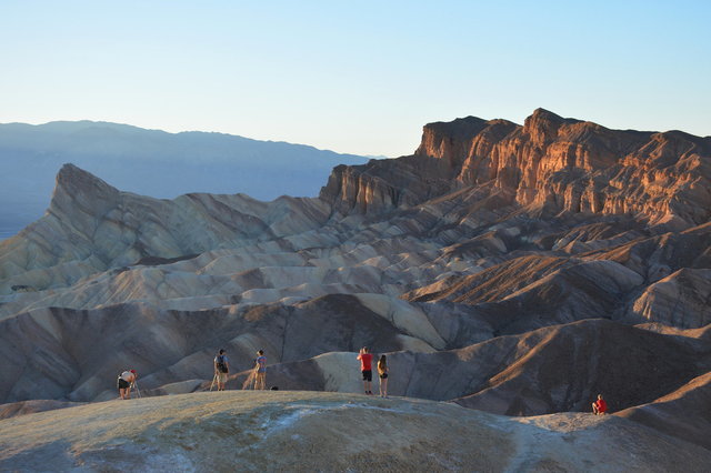
Our last stop of the day was Zabriskie Point, an overlook offering a view of badlands and the sun setting over the Panamint Range on the other side of Death Valley. In contrast to the rough trails at Ubehebe Crater and Mosaic Canyon, and the shifting dunes at Stovepipe Wells, this overlook featured a wide, paved, accessible path leading from the parking lot.

We weren't the only people who had gotten the idea to watch the sun set; there were a couple dozen other people -- more than we'd seen all day long -- many with cameras and tripods, set up at the overlook.
We watched the sun set behind the mountains, then headed back to our camp site at Furnace Creek Campground for one more night before returning to civilization.

