Tomales Point
Started: 2017-07-22 20:20:16
Submitted: 2017-07-22 23:18:06
Visibility: World-readable
24 June 2017: In which the intrepid narrator hikes to Tomales Point, on the northern tip of Point Reyes National Seashore
On a map of the central California coast, Point Reyes sticks out into the Pacific Ocean like it belongs more to the ocean than the mainland it's only tenuously attached to. In a sense that's true -- geologically Point Reyes is made up of a bunch of rock that ought to be elsewhere; it's been pulled hundreds of miles north-west on the Pacific Plate along the San Andreas Fault. The San Andreas rift zone -- where the plates slide along each other -- forms Tomales Bay, separating the northern part of Point Reyes from the mainland, and park headquarters has a short interpretive trail leading up and over the fault past a reconstructed fence that was pulled apart by the 1906 earthquake.
As a kid, looking at maps of the region surrounding San Francisco, the point fascinated me, though I don't recall actually visiting it. I've seen the point from airplane windows flying into San Francisco from the north. Last summer I staged an expedition to Point Reyes (it appears I neglected to blog about it at the time, but here's a picture I took descending the stairs to the lighthouse perched on the cliff at the very south-west corner of the point).
The land is administered by the Park Service as a National Seashore (one of the dozen or so Park Service units in the Bay Area, and large pieces of it are administered as wilderness. The seashore has an interesting relationship with the ranchers and oyster farmers that lived on the land before the seashore was established; the Park Service is more comfortable preserving natural landscapes and historic sites than with exploiting them for agriculture. A couple of years ago the Park Service shut down an oyster farm operating in Drakes Bay whose lease had run out, and today dairy farms are still operating inside the boundaries of the seashore.
All of these things were running through the back of my mind as I set out to hike to Tomales Point, the very northern tip of Point Reyes.
I drove across the Golden Gate Bridge and through winding mountain roads in Marin County to the little town of Point Reyes Station, then crossed the San Andreas Rift Zone and drove up the western side of Tomales Bay, then past working dairy ranches to the end of the road at the historic Upper Pierce Ranch, with most of the hundred-year-old dairy ranch buildings preserved with some interpretive signs.
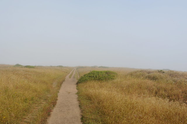
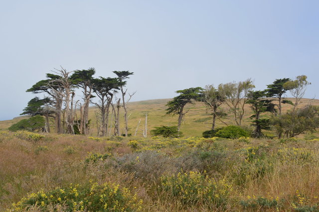
I set out on the trail to Tomales Point under cloudy skies. This part of the point was mostly barren except where eucalyptus and cypress trees had been planted as a windbreak; the sandy ground was mostly covered by golden brown grass, with only the occasional flowering shrub.
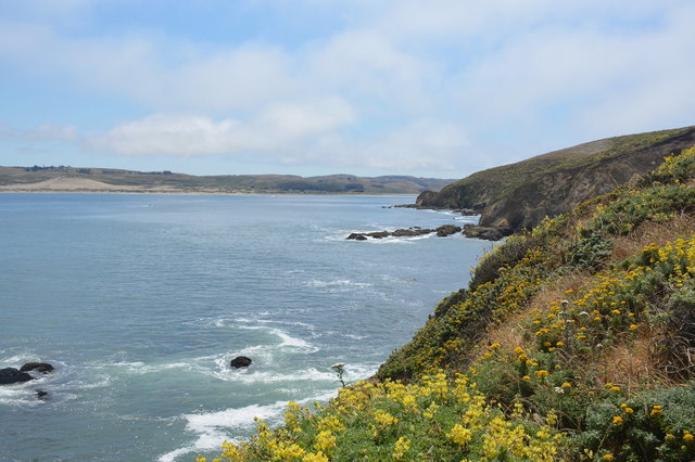
The trail spent most of its time on the western side of the ridge, perched high above the vast expanse of the Pacific Ocean. I couldn't always see the ocean, hidden behind the gentle curve of the rolling hills and obscured by the fog.
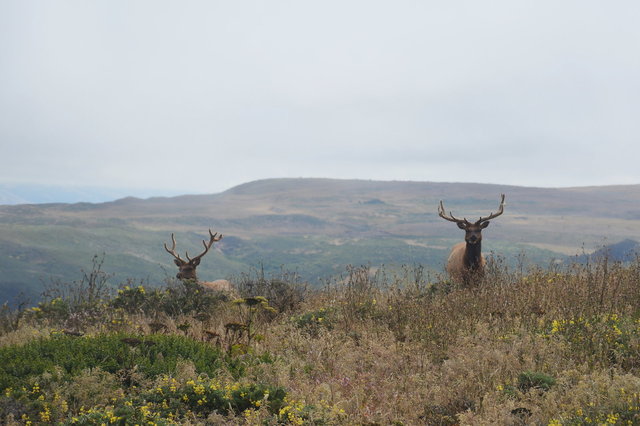
Point Reyes is home to a large wild herd of tule elk, which have been reintroduced into their historic range after being hunted into near-extinction at the beginning of the last century. I saw some smaller groups of elk on my outbound hike, and a much larger herd on my return.
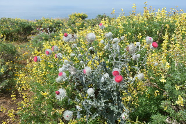
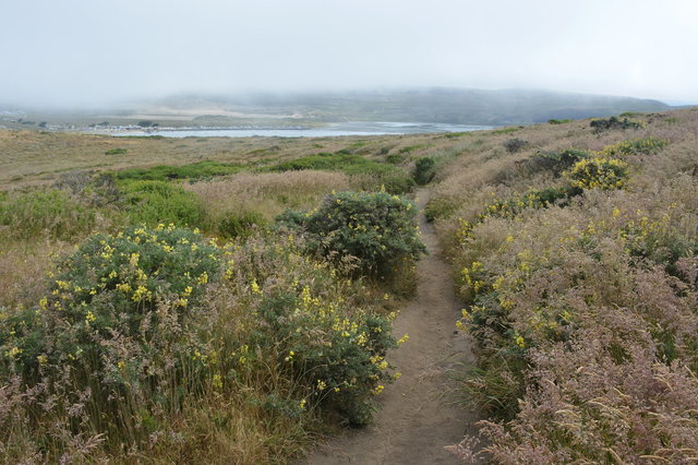
Beyond the cypress windbreak, the clouds lifted as the trail climbed gently and the golden grassland gave way to bright wildflowers: brilliant yellow flowers on tall shrubs (which I later identified as coastal brush lupine), delicate white-and-lilac flowers on a scraggly perennial, and the occasional bright red and steel gray thistle (which I later identified as cobweb thistle).
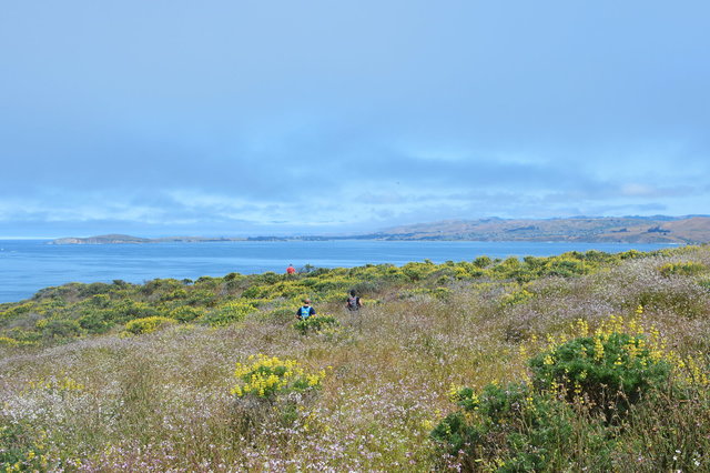
The trail began a gentle descent to the end of the point, and I could feel the land on either side of the narrow ridge begin to taper as I approached the end of the point. The lupine shrubs grew on both sides of the trail, thick with their brilliant yellow flowers, threatening to overtake the trail and strand us on the point. Between the blue of the ocean, the white of the breakers, and the green and yellow of the shrubs, I felt like I was walking through an oversaturated Technicolor wonderland, on an epic fantasy quest to find the macguffin waiting for me on the end of the point. I imagined the camera rising up from behind me, showing my path through the field covered in flowers, accompanied by a swelling orchestral score.
As I got closer to the end of the point, I imagined I might meet a sadhu sitting in a lotus position on a rock at the very end of the point, gazing out into the ocean, dispensing cryptic wisdom in the form of zen riddles.
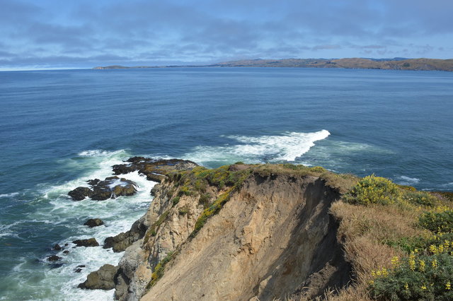
The ridge narrowed further, and the last section of trail had been lost when the bluff it was standing on collapsed, but a rough social trail had been formed around bypassing it. I picked my way down to the end of the point, as far as I dared go on the crumbling cliffs, still ten meters above the waves. Neither the macguffin or the sadhu were in evidence, but I didn't much care.
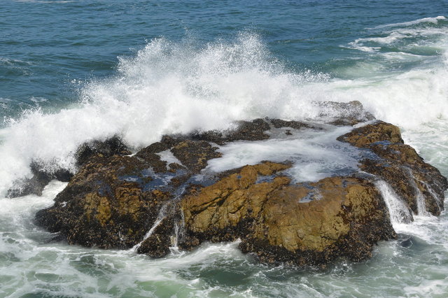
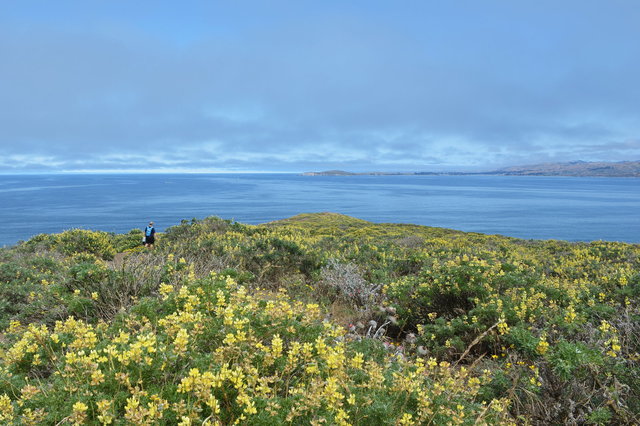
I stood on the end of the point, surrounded on three sides by water: the boundless expanse of the Pacific Ocean to the west, Bodega Bay to the north, and Tomales Bay to the east. Waves broke on the rocks around me, throwing spray high into the air, never quite reaching my perch on the end of the crumbling cliffs.
I ate a snack, watched one or two harbor seals swim in the water below, talked to some of the other hikers at the end of the point, before turning back to retrace my steps back to the trailhead. A Sonoma County Sheriff helicopter flew in lazy loops around a couple of boaters in the ocean, then headed back to land.

Even though I went back on exactly the same path, I saw the terrain differently. The clouds returned as I walked south, but dissipated again before I reached the trailhead, showing the terrain in different light.

I returned to the trailhead and drove back to San Francisco, refreshed by my time in the wilderness.
For more photos from my hike to Tomales Point, see Photos on 2017-06-24.
