Hellhole Palms
Started: 2019-02-12 22:03:33
Submitted: 2019-02-13 22:18:13
Visibility: World-readable
20th January 2019: In which the intrepid narrator hikes around the Colorado Desert (and observes that the desert is actually in California)
I have a vague memory from childhood of visiting a family friend somewhere in Southern California and going for a hike in the desert to a palm-lined oasis somewhere at the end of the trail. In my memory the hike to the oasis was hot and dry, and I was refreshed by the water at the oasis for the hike back. I've come to associate this memory with Anza-Borrego Desert State Park; talking to my father partially confirms this version of events.
My short trip to Anza-Borrego Desert State Park in January gave me one day to spend in the desert, starting from the town of Borrego Springs.
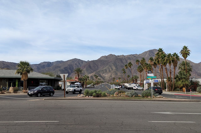
I ate breakfast at a cafe in town, then drove to the park's visitor's center, buried in the ground on the floor of the Borrego Valley with rugged, barren peaks climbing to the west. It was the middle of January, in the middle of winter for any reasonable definition, and by mid-morning the temperature was a balmy 72°F.
(The park's website pointed out that the state park was still open during the Federal government shutdown -- it being a state park, unlike Joshua Tree National Park, a few hours away.)

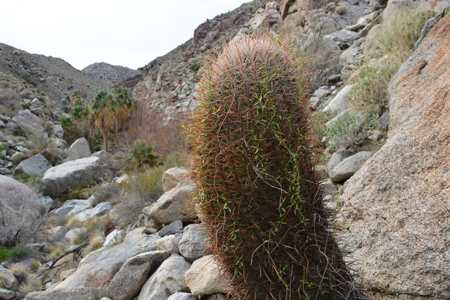
The park's visitor's center was buried in the ground to give it insulation from the harsh summer heat. The architecture of the building, and the parking lot, and the restrooms gave the impression of buildings designed to handle great heat, which felt a little weird in the winter. I walked around the interpretive trail circling through the desert, complete with signs identifying various cacti and shrubs adapted to the desert -- as well as a small strand of fan palms, the last remnants of the native palm trees from an earlier, wetter epoch.

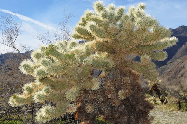
I was especially amused by the "Teddy Bear Cholla", looking very much like a cuddly fuzzy cactus (though I knew better than to hug it).
I stepped inside the visitor's center to orient myself, and ended up with an ample supply of books, maps, and other pamphlets to interpret the desert.
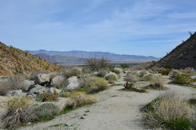
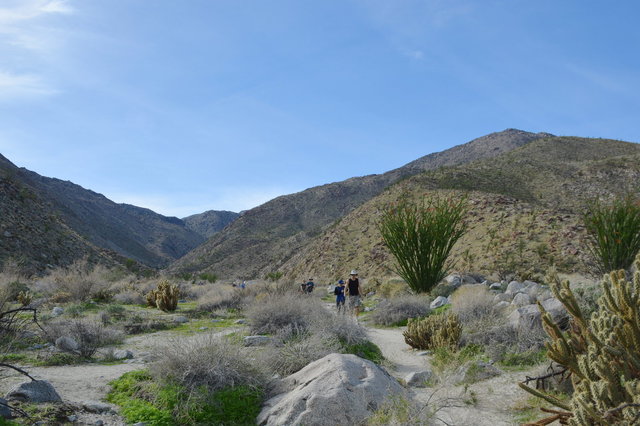
I set out on foot from the parking lot, heading south across the desert towards the mouth of Hellhole Canyon, across sandy ground covered with cactus and scraggly shrubs adapted to the harsh desert existence like tamarisk and octillo.
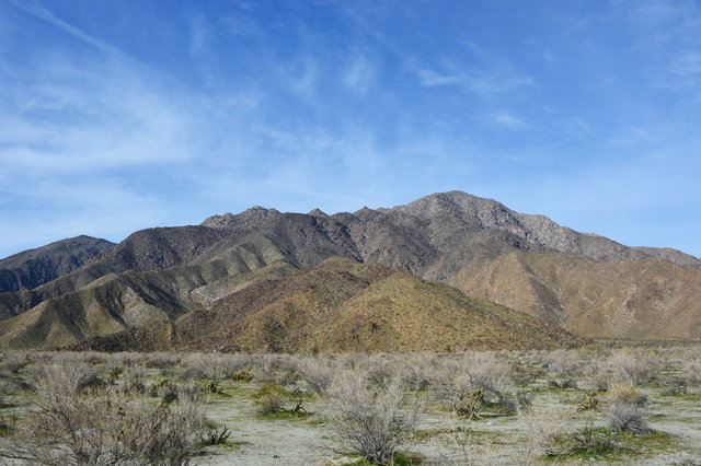
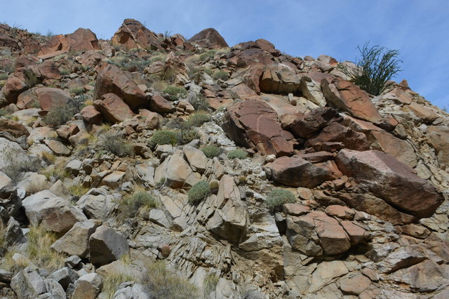
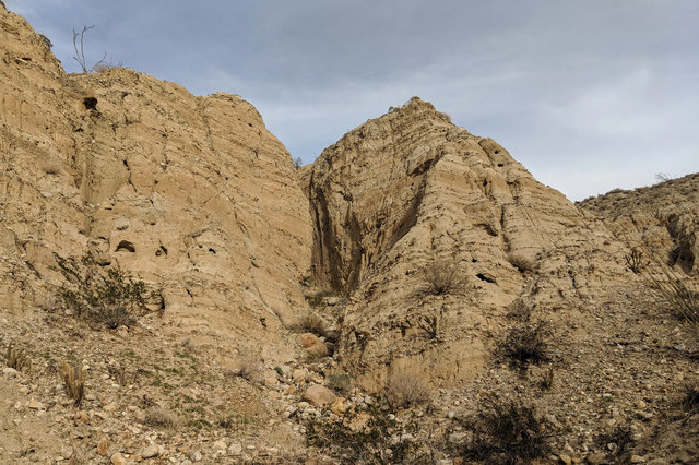
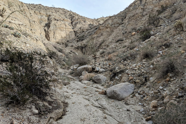
The trail from the visitor's center joined the main trail heading west towards Hellhole Canyon. The trail climbed gently along the dry wash that drained the canyon, as the walls of the canyon, covered with scrub and shaded green with grass fed by the winter rains, closed in around the boulder-strewn floor of the canyon.
In the canyon, the trail climbed westward, across the sandy floor of the canyon (no doubt washed clean by irregular floods that flashed across the landscape, only to disappear again), scattered with car-sized boulders. Soon I spotted the canyon's first palm trees, standing defiantly in the middle of the desert, kept alive by the residual water in the dry wash running down the valley floor, augmented by the occasional flood.
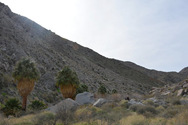
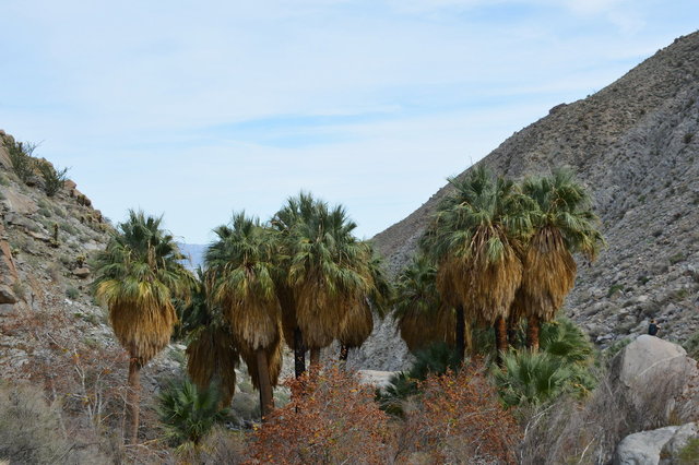
Mid-way through the canyon I found a dense grove of palm trees nestled in between a couple of house-sized boulders. These were the eponymous Hellhole Palms, the symbols of the oasis in the middle of the desert. The shade under the trees was cool and inviting under the warm January sun.
I turned around when I reached Maidenhair Falls, a tiny trickle of water running over a ten-meter-high boulder forming a chock stone making it difficult to move further up the valley. The water falling down the boulder in the shade of the canyon floor fed moss and ferns on the rock, looking out-of-place in the middle of the desert. The grotto at the bottom was filled with college students from a nearby University of California school; I retreated to a nearby clearing to eat the snack that I decided to count as my lunch.
I headed back down the canyon, retracing my steps across the same terrain but getting an entirely new perspective heading back to the Borrego Valley.
As the trail opened up to the Borrego Valley, it led past octillo shrubs towering over the trail, their thick branches bristling with tiny green leaves and large thorns, capped by tiny red flowers portending the beginning of their spring growing season.
I returned to the trailhead at the visitor's center early in the afternoon, after a seven-mile round-trip into Hellhole Canyon.
I drove back into town, then turned north at Christmas Circle, the large lazy roundabout in the middle of Borrego Springs, into Galleta Meadows, a field scattered with large metal sculptures. The first Sky Art sculptures represented animals found in the fossil records of the Borrego Valley; further along I saw a 100-meter-long serpent erupting from the ground like a Chinese dragon dressed up as a sand worm from Dune.
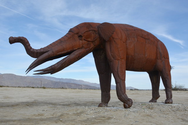
I drove among the sculptures, trying to figure out how to interpret them, seemingly out-of-place on the dusty floor of the desert, removed from the fertile savanna they roamed in life millions of years ago.

I drove past the Sky Art sculptures, then past miles of emerald green citrus fields fed by wells drilled into the aquifer far beneath my feet, to the northern extent of the Borrego Valley, as far on the dirt road leading towards the four-wheel-drive road in Coyote Canyon as I felt comfortable in my two-wheel-drive rental car, to Desert Gardens, a tiny picnic area perched on a shelf above the intermittent Coyote Creek. The high haze that hung over the valley since noon was thickening into actual clouds, but never threatening rain.
I got out of the car and followed a faint social trail into the ridge on the north end of the valley, past a promontory identified only by a tentative elevation -- 1045 feet above sea level -- on the topographic map. The trail led gradually upwards through the desert, here populated almost exclusively by two-meter-high octillo shrubs, heading towards a dry wash draining the hills. I had neglected to bring my pack, with my supply of water and food and my GPS receiver and my SLR camera; but I had my phone and I was curious to see just how far the trail would take me.

I followed footprints in the soft dirt into one branch of the wash, curving behind a low ridge that had separated me from the Borrego Valley, and from my car parked by the dirt road. Canyon walls rose abruptly to my left, reminding me of Mosaic Canyon in Death Valley: another dry canyon in the desert in California.
By this point the trail had been reduced to a couple of sets of footprints, and I let my curiosity lead me further into the canyon. I wondered what secret I would find at the end. I could see no more than twenty meters ahead of me into the canyon, and at every turn I wondered if that would be the end of the canyon, but at every turn there was more canyon and I kept going.
Soon the canyon grew steeper, but the dirt on the floor of the wash remained soft, and some of the microwave-sized boulders I stepped on shifted underfoot. Eventually the wash gave way to a slope, set somewhere around the angle of repose for the rocks and stones and sand and dirt that made up the slope; then the slope flattened out and I walked several more meters to the small carin that had been built at the unnamed summit.

This summit, at least, mustered several closed contours on the topographic map; I decided to identify it as Point 1651, after its provisional elevation on the map.
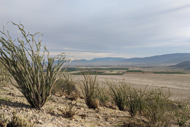
From the top of Point 1651, I had a commanding view from the north of the Borrego Valley, with the citrus fields I'd passed in the car laid out like squares on a map. There were still higher mountains around me, but I had found a local maximum, and I felt like I'd accomplished something in my unexpected hike.

On my descent to my rental car, I stayed higher on the ridge (following, I noted, the footprints of other people who had apparently had the same idea I did), then descended into the tiny unnamed wash immediately north of the wash I had ascended. As I expected, this route was a more gentle descent, avoiding the shifting sands and unsteady rocks in the wash. The only tricky part was near the bottom of the ridge, where the mud on the ridge was hardened and slippery but for the small, fist-sized slippery rocks that made it difficult to find stable footing.
Satisfied by my time outdoors, I drove back to my hotel, eventually eating supper at Kesling's Kitchen in town, then prepared to return to Seattle the next day.
I felt refreshed by my time in the desert, gratified by the chance to dry out from the rain in Seattle, with the winter sun climbing higher and brighter in the sky. The Colorado Desert felt immediately familiar to me, a place shaped by water that was more often than not entirely absent. It reminded me of growing up in Colorado -- in an arid climate more like the desert than Seattle (or the Bay Area) -- and visiting the deserts of the American Southwest (and, more recently, Death Valley). But as familiar as it felt, I was content to remain a visitor: I didn't immediately feel at home, and I didn't want to stay; and that felt significant, somehow, as I try to figure out what kind of life I want to make for myself in Seattle.
For more photos from my day in Anza-Borrego Desert State Park, see Photos on 2019-01-20.
