Harbor
Started: 2024-07-22 19:55:16
Submitted: 2024-07-22 20:52:51
Visibility: World-readable
Paddling in Monterey Bay from Santa Cruz Small Craft Harbor
I had Friday the Fifth of July off as a holiday, which turned out well because I got back from watching fireworks on a boat in San Francisco after midnight. I had a slow start to my morning, then headed out to Santa Cruz Small Craft Harbor with my kayak to paddle in Monterey Bay.
The harbor focuses on small motor boats and sail boats, but it has a couple of small docks for hand-launching personal watercraft. (My kayak is seventeen feet long, which is long for a single kayak, and barely fits in my garage, but I have a neat hoist that suspends it above the hoods of the cars when it's not in use. But it's still small enough that I can drag it around myself and carry it from my car to the dock.) I backed into a visitor's parking space next to the hand-launch dock so I could lift my kayak and carry it straight to the dock, but when I got it down to the water I realized that I had forgotten an essential piece of gear: my kayak paddle. I hauled my boat back onto my car, drove across town, picked up a paddle, and returned to the harbor. I got the same space back and launched into the protected water of the harbor.
I paddled along the boats docked in the harbor to the mouth of the harbor, past the space where a dredging barge usually sits but was missing, possibly for the summer. (The shore current pushes sand along Seabright Beach past the jetty at the mouth of the harbor, where it tends to shoal in the mouth of the harbor. The harbor used to be a lagoon until it was dredged and extended with a permanent opening to the bay in the middle of the last century. The jetty traps sand on Seabright Beach, which is great for the beach (giving the cliff-top houses above the beach a temporary respite from the relentless erosion, leaving large slabs of sidewalk hanging in space at the edge of the cliff) but less great for the mouth of the San Lorenzo River on the other side of the beach.) I paddled past the jetty and the Walton Lighthouse at the mouth of the harbor and turned into the open waters of Monterey Bay.
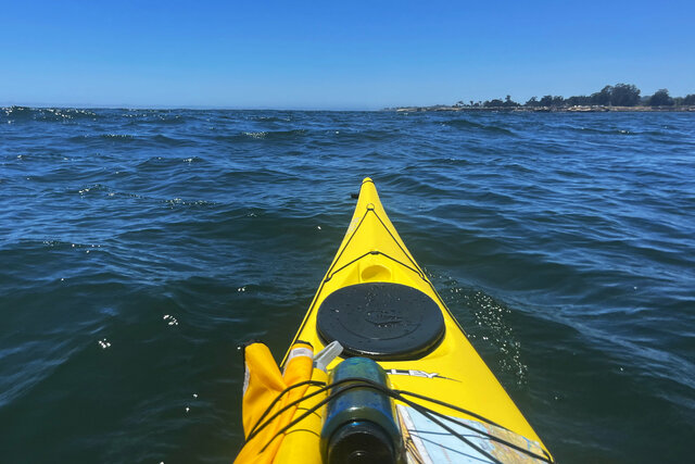
It was a bright sunny day, and there was a light breeze coming from the south-west across the bay. The breeze brought with it tiny waves that were barely noticeable but were just large enough that, on my initial course heading east towards Live Oak in the direction of Capitola, the waves hit my boat from an awkward angle. I soon gave up trying to paddle in that direction and turned towards the wind (which turns out to be easier than paddling at an oblique angle to the wind, because the wind tends to push my boat like a sail if I'm not facing straight into the wind) and paddled in the opposite direction, setting out into the broad anchorage somewhat protected by Lighthouse Point to the west. A line of clouds blocked my view of the horizon, preventing me from seeing the Monterey Peninsula across the bay. I was facing straight into the waves, which was the direction my boat wanted to travel. It gave me a better chance to respond to the waves, even as they occasionally washed over the front of my boat, covering my waterproof topographic map in salt water, and splashing against the spray skirt keeping the water from entering the cockpit where I sat.
I paddled two miles across the mouth of the anchorage to the vicinity of Lighthouse Point, marking the end of Monterey Bay and the beginning of the Pacific Ocean. I looked out into the open ocean, stretching to the clouds obscuring the horizon, then turned back to the more-protected waters of the anchorage.

There were surfers in the water at Steamer Lane, at the bottom of the cliffs on the east side of Lighthouse Point. I stayed far enough out in the water to avoid the larger waves they were trying to catch. I paddled over kelp forests, visible mostly by the fronds floating at the top of the water like a mat. I spotted at least one sea otter hanging out in the kelp, plus numerous surfers in the waves. (From far enough away a surfer head in the water looks sort of like an otter head, though surfers usually have surf boards nearby and they're not natively marine mammals.)

I paddled into the cove towards Cowell Beach, then headed towards the wharf. The last time I kayaked here there was a specific route marked under the wharf for kayaks, but I couldn't remember how I found it. As I approached the wharf I saw a buoy near the wharf, and then I spotted arrows on signs identifying the specific spot I was supposed to paddle. Barnacles clung to the columns supporting the wharf, and I could hear the sea lions at the end of the wharf barking at each other. I emerged into the other side of the wharf right in front of Main Beach at the Beach Boardwalk, covered with people enjoying the sun. I paddled past the buoy marking the edge of the swimming area and past Seabright Beach, where I could see that the lifeguard stations on the beach were flying their black ball and rip tide flags. I passed the beach and turned into the Small Craft Harbor, then pulled myself out of the water at the hand launch dock, back on dry land after a few hours paddling in the water in Santa Cruz.
