Kilauea
Started: 2018-04-01 19:34:56
Submitted: 2018-04-02 22:42:07
Visibility: World-readable
In which the intrepid narrator sees Kilauea Volcano on the Big Island of Hawaii and contemplates the vastness of the Pacific Ocean
We awoke early, local time, on our first full day in Hawaii, as the gentle chirping of the coqui frogs gave way to roosters crowing. We were still slightly jet-lagged from flying three time zones to the west on the previous day. (Julian woke up at 05:00 HST -- which sort of counted as sleeping in until 08:00 Pacific.) The daylight gave us a chance to get a better look at our Airbnb -- it was a cute house in a big lot lined with bamboo, banana, and other tropical plants, with chickens wandering through the yard.
I messaged our Airbnb host to ask about the absence of hot water and gas for the stove, and he sent his local contact (who lived next door) over to turn the handle on the propane intake to select the newly-replaced, larger propane tank. With the right propane tank selected, the hot water worked, giving us the opportunity to shower.
With our morning preparations out of the way, we drove to the nearby Hawaii Volcanoes National Park. (Being able to see an active volcano was top on our list of reasons to come to the Big Island.) We poked around the visitor's center, looked at the exhibits, saw the details of the difficult, 11-mile-round-trip hike to see lava (some of it cross-country across recent lava), took a walk through the gift shop, and finally saw the 3D relief map of the entire island to help orient me with respect to the main caldera and the current active lava flow.
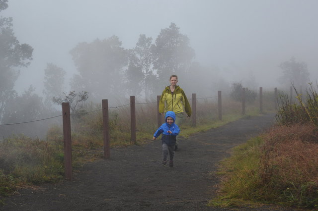
We drove down the road along the crater rim and stopped at the Steam Vents, a series of cracks where ground water was geothermally heated to steam and exhausted into the air. The steam was warm but didn't smell of sulfur, and it was hard to tell at a glance the difference between the steam and the fog. (We skipped the sulfur vents across the street; I missed them on our first pass, and Kiesa expressed negative interest in smelling the sulfur.)
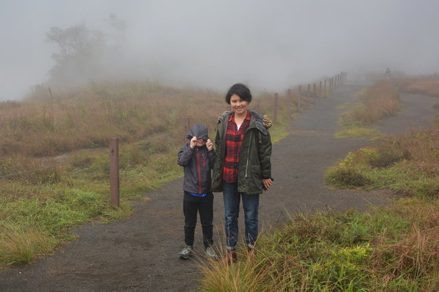
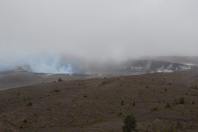
We continued along the Crater Rim Drive to the Thomas A. Jaggar Museum, named after a pioneering geologist who studied the Hawaiian volcanoes. From the overlook on the caldera rim we could look down into Halema'uma'u Crater, currently a bubbling pool of lava, though from our vantage point and the fog all we could see was the pale blue smoke rising from beyond the cliffs at the floor of the crater.
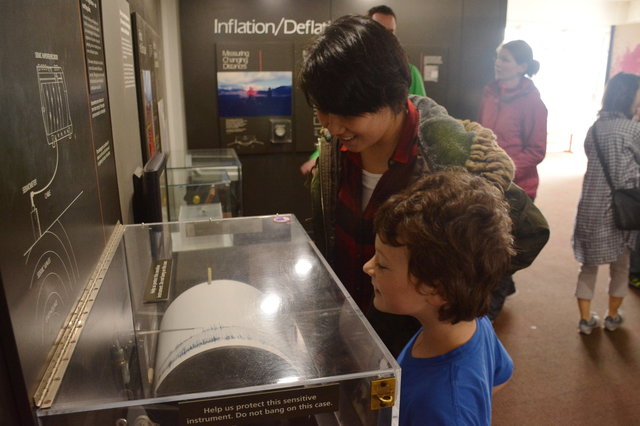
We looked around the museum at the exhibits on geology, and the geology of the Hawaiian volcanoes, including a seismograph recording the shaking of the floor as visitors walked by -- or jumped on the floor just to watch the needle wiggle.
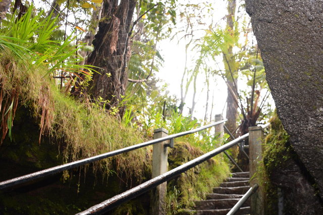
We ate lunch at a picnic shelter near the museum, then drove to the Thurston Lava Tube, a short lava tube running through the jungle. (Hawaii is riddled with lava tubes; many of which are open for tourists. This one was relatively tame; some feature multi-hour guided adventures crawling up and down the winding network of tubes. Some lava tubes are currently running with lava, feeding the gentle eruption a few miles from where we stood.)

This tube was fairly short, with a short loop walk that climbed down stairs where the ceiling had collapsed, then walked through a gently-curving section of tube. The tube was illuminated by waist-high lights on one wall, providing an eerie orange glow of the bottom section of the cave. Water dripped from the ceiling, a nice change from the rain outside, and roots hung at intervals, dripping water and searching for purchase in thin air.

(I took the photo above in a single exposure with my flash, giving a split view of the tube: the bottom of the tube was lit by the lights on the wall, while the top of the tube hung in darkness except where illuminated by my flash.)
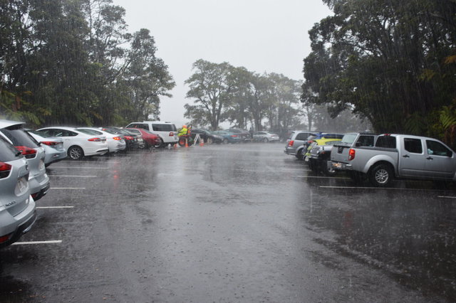
The trail emerged into the rainy jungle after a few hundred meters of lava tube, and looped back on an asphalt trail back to the road. We ended up parking at the backup parking lot a half-mile away, and during the half-mile walk back to the car the rain picked up into a downpour. It was relatively warm, by the standards of most rainstorms I've experienced (though we were at 4000 feet, so it was colder than one might otherwise expect in the tropics), but still wet.
From the safety of the car we drove down the Chain of Craters Road and gaped at the varied scenery where the lush jungle gave way to lava, under the constant rain. In places where the road was rebuilt to travel over twentieth-century lava, the fog covering the ground gave an otherworldly appearance.

The rain subsided as we approached the cliffs descending the last 2000 feet to the ocean. I got out of the car to walk over the smooth pahoehoe lava, noticing the variations in the surface and the cracks as foot traffic crushed the rocks -- and marveling at how much like the stereotypical landscaping rocks the ground looked.


The lava was interrupted by wiry pioneer trees with bright red flowers that reminded me of the bottle-brush trees (aka New Zealand Christmas tree) popular as landscaping trees in San Francisco. I briefly threatened to call it a "Hawaiian bottle-brush tree" or "Hawaiian Christmas tree" before I found it in the pocket guide to Hawaii's trees and shrubs I bought at the national park visitor's center and learned it was an ohia lehua tree, endemic to the Hawaiian islands, and found nowhere else on the planet. Not only does the multipurpose tree colonize new lava, it also makes up the backbone of Hawaii's jungles. (Hawaii is one of the most isolated places on the planet, so many plants evolved independently here.)


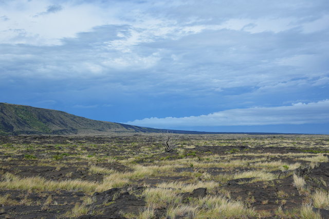
We continued our descent on the road towards the ocean and stopped on the coastal plain, where the lava was hundreds of years old and had been colonized by grass and the occasional shrub.
We stopped to walk out to petroglyphs carved into the lava rock. Some were obvious humanoid figures; others were concentric circles; and others were small holes ground into the rock. I got more out of the prehistoric site watching Julian run around the boardwalk.

I spotted clouds to the west, with a stiff breeze blowing from that direction, and predicted that we ought to get back to the car before it started raining again. We walked back across the lava, picking our way between the lava hillocks and around the puddles that formed in the rock, following the cairns set up to mark the trail. The terrain reminded me of walking on glacier-polished granite above treeline in the Colorado Rockies, gently rolling around boulders and ponds; though the rock itself was very different.

We returned to the car just as the rain started, and drove to the end of the road at the Holei Sea Arch. Prior to 1983 the road ran along the coast to leave the park, but lava erupting from Puu Oo on the eastern boundary of the park cut off the road, destroying the Royal Gardens Subdivision just outside the park boundary. In 2014, as the lava was threatening the town of Pahoa, the road was rebuilt as a gravel emergency road providing an escape in the event that the lava overwhelmed the normal highway.
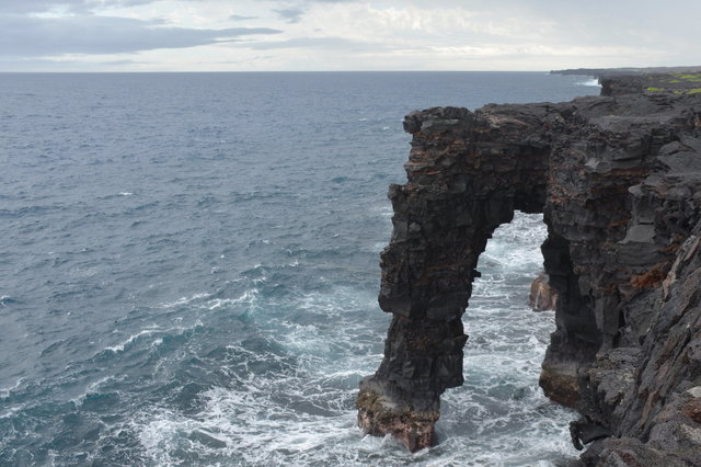
I walked to the cliff overlooking the ocean and leaned out as far as I dared to gaze at the sea arch, formed when part of the rock eroded faster than others. Waves broke on the rocks below, occasionally splashing high enough to threaten the viewing area. From the cliff above the ocean, I gazed out onto the horizon, and wondered how far I'd have to travel to find land. I faced south-southeast; the nearest land in that direction was Antarctica, more than six thousand miles away -- a quarter of the entire planet's circumference -- across the Pacific Ocean. I was humbled by the size of the planet and dwarfed by the shear scale of the ocean.
We turned around from the dead end and drove back up the Chain of Craters Road, stopping at one more crater on our way out before heading to a Thai restaurant in Hilo for supper. We dropped by Safeway and Target for more fortifications on our way back to our Airbnb for the night.

For a few more photos from my day at Kilauea Volcano, see Photos on 2018-03-26.
