Sunset Beach
Started: 2018-08-15 17:01:01
Submitted: 2018-08-16 10:05:35
Visibility: World-readable
7 July 2018: In which the intrepid narrator hikes between the water and cliff
When I planned my last few weeks in San Francisco, I wanted to kayak in Drakes Estero, the large protected inlet on the south side of Point Reyes. But the weather forecast looked too windy to have a good experience on the water, so instead of kayaking on Drakes Estero I decided to hike along side it, following the hike to Sunset Beach from current my favorite hiking guidebook, 101 Great Hikes of the San Francisco Bay Area, 5th ed, by Ann Marie Brown.
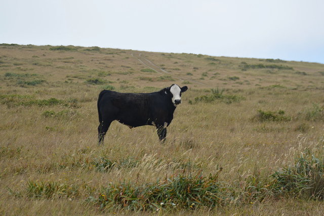
I drove along Sir Francis Drake Boulevard through Point Reyes in the morning fog, then turned off onto the access road leading to the Drakes Estero Trailhead, through rolling grassy hills covered fog. Much of the grassland on Point Reyes is still used as pasture for cattle, producing (among other things) the blue cheese I ate for supper the previous night, but I didn't see any cattle along the road.
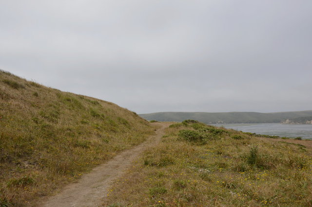
I parked and followed the trail down a gentle hill from the trailhead, descending into a pine grove, dripping with condensation in the morning fog. To my left I caught glimpses of water, until the trail emerged onto the Home Bay arm of the estuary and crossed the channel on a low footbridge.
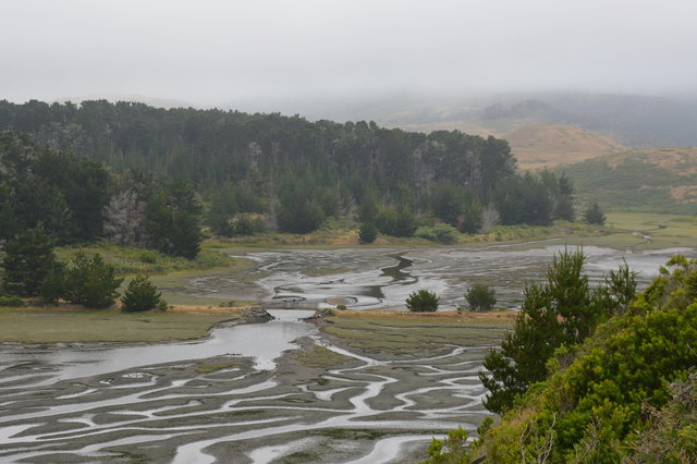
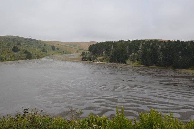
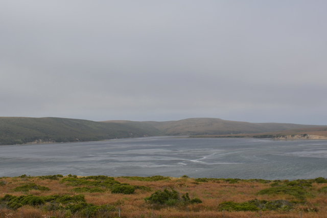
The tide was low, exposing the muddy bottom of the arm, cut with tiny maze-like channels. To the east the water dwindled into mudflats into low marshes into hillsides covered by golden grass and low shrubs. To the west the main body of the estuary sat under the clouds.
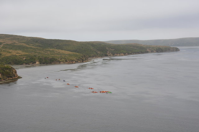
The trail climbed a bluff above the water, and soon the estuary opened up, giving me a better view of its next two arms, Schooner Bay and Creamery Bay. I saw a group of kayaks on the water, which seemed to be having a rough time in the wind whipping across the water and up the bluff over the trail (though the water still looked calm, so it might have looked worse than it was). I decided later that they were likely a tour guided by one of the outfitters operating in Point Reyes, which I could have signed up for had I been paying attention in advance, though given the wind I think I had a better day hiking on dry land.
The trail descended to a series of gates intended to keep cattle in their intended pastures, and soon I saw groups of cattle grazing languidly in the pasture, chewing their cud and watching me walk by on the trail. I wondered if I had eaten cheese made with milk from these cows, or whether my blue cheese had come from cows elsewhere on Point Reyes.
The trail climbed and descended the rolling hills above the estuary, heading first west then south towards the mouth of the estuary on Drakes Bay.
In the water below I could see the mud flats stretching into the estuary, barely covered by the low tide, smeared with algae and sea grass. I could see harbor seals on the beaches below, and birds everywhere.
The trail finally descended into a narrow valley where it met the marsh near the mouth of the estuary. Here the maintained trail ended, but my guidebook suggested continuing to follow the unmaintained trail through the marsh to Sunset Beach. (The guidebook specifically cautioned against trying to bypass the marsh by scrambling up the hill, since the hill was covered in poison oak.)
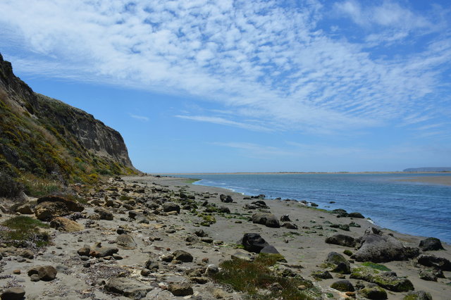
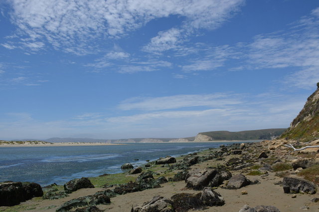
At the end of the marsh I found Sunset Beach, a narrow slice of mud strewn with rocks pockmarked by erosion, nestled between sedimentary cliffs and the azure waters at the mouth of Drakes Estero. The clouds had cleared, giving me my first glimpse of blue under partly-cloudy skies.
According to my guidebook, I had reached the end of the hike, and ought to turn around to retrace my steps to the trailhead; but the gentle lapping of the water on the beach and the promise of better views of the mouth of the estuary (and the view of Limantour Spit, across the narrow channel from the beach) lured me further on the beach. It looked like the beach's high-water-mark was around the base of the cliff at the beach's edge, so I didn't want to be on the beach anywhere near high tide. I double-checked the tide, and confirmed that it was at its lowest ebb and would continue to be low for hours, which ought to be enough time to walk a mile along the beach to Drakes Head, an overlook that my guidebook suggested on a clear day.
I walked along the beach, with the crumbling sedimentary cliffs to my left and the water to my right, picking my way across the rocks strewn on the beach and the mud that threatened to envelop my shoes if I walked too close to the water. Just across the water was a large sandbar where harbor seals had hauled out and were lounging on dry land.
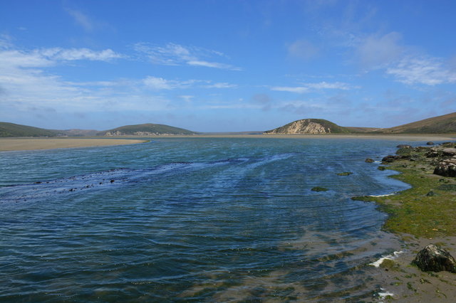
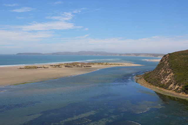
I followed the narrow beach into a muddy inlet, then crossed the creek that flowed into the inlet when it became narrow enough to cross easily, and scrambled up the hill opposite, meeting up with the trail to Drakes Head. I followed the trail to the end of the head, overlooking Limantour Estero, with a commanding view of Limantour Spit and Drakes Bay, with the hammerhead forming the main body of Point Reyes looping around on the horizon opposite the bay.
I followed the trail back from Drakes Head, through rolling hills covered in golden grass, much of it outfitted as pasture land, with fences and large watering troughs (some of them obviously derelict) before rejoining the trail I started on, forming a lollipop loop.
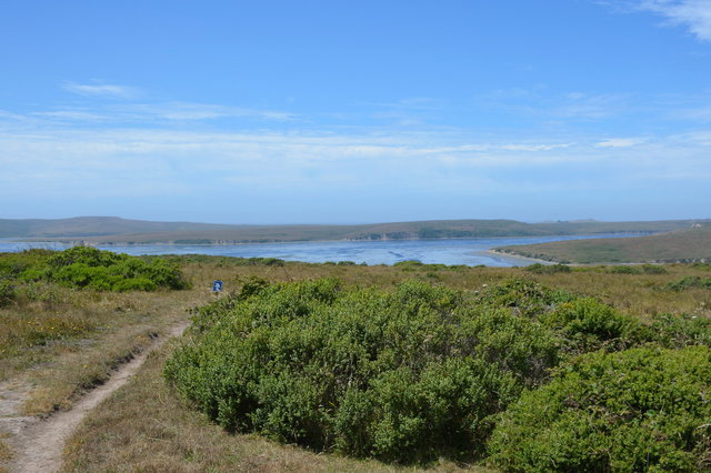
I followed the trail back along Drakes Estero, now seeing the water under blue skies, eventually returning to the trailhead after a great day hiking at Point Reyes.
To celebrate my hike I drove to Point Reyes Station and ate a delightful blue cheese pizza at Cafe Reyes, and wondered whether the cheese had come from any of the cows I'd seen above Drakes Estero.
For a few more pictures from Drakes Estero and Sunset Beach, see Photos on 2018-07-07.
