North View
Started: 2020-01-27 22:02:37
Submitted: 2020-01-28 00:33:48
Visibility: World-readable
11th January 2020: In which the intrepid narrator hikes the North View Trail in Joshua Tree National Park, takes a driving geology tour, and sees (but does not touch) cuddly cactus
With just one whole day to spend in Joshua Tree National Park, I studied my guidebook and maps for the best desert hike to take to bring me face-to-face with the Joshua trees dominating the desert landscape and selected the North View Maze Loop route.
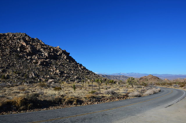
I ate breakfast in Joshua Tree, then drove into the park and parked at the trailhead not quite two miles inside the park entrance. In the distance I could see snow at eleven thousand feet on San Gorgonio Mountain; at my elevation inside the park the landscape was dominated by rolling hills made up of large boulders, with dormant grass and spiny Joshua trees in the valleys.
I headed to the Maze Loop Trail but misinterpreted the markings on the trail signs and turned onto the North Canyon Trail, a hundred meters ahead of the left turn I was supposed to take. This trail dropped quickly into a narrow canyon between two hills, following the wash north for a kilometer before turning north-west and climbing out of the canyon onto the shoulder of an unnamed hill with a sweeping view of the Mojave Desert to the north.
This was where I realized that the trail I had intended to follow should have taken me to the north-east, up onto the hill to the east, rather than into the small canyon. I consulted my map and saw that if I kept going, and kept to the left, I could loop back to the trailhead and continue the route I had intended to take -- albeit with a two-mile detour. This detour, I reasoned, I could afford to take, because I had plenty of water and plenty of time.

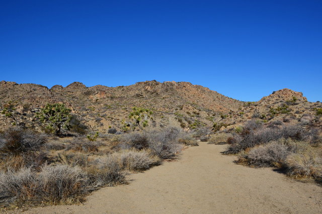
The trail looped around a small hill, eventually turning back towards the trailhead where I started. From the trailhead I saw my mistake, and found the correct trail a hundred meters to the east. This was the North View Trail, the trail I had intended to take in the first place, which climbed up to an unnamed rocky hill (which I designated "Point 4400", based on its elevation on the topo map, identified only by a closed contour at 4400 feet).

I took a spur trail to Copper Mountain View, on the far side of Point 4400, overlooking the Mojave Desert to the north, including a modest hill named Copper Mountain. I continued along the trail, taking another spur to an overlook to the south-west, then followed the trail as it descended along the side of a ridge, then dropped down into a wash at the bottom of the ridge. (The wash is apparently too intermittent to even be marked as an "intermittent stream" on the topo; it's visible on the map only as the long fingers of contour lines indicating a narrow canyon.) Here I saw snow on the ground, though the sun was warm enough that I spent most of the day in short sleeves.

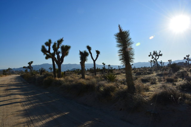
The trail emerged into a flat stretch of desert dotted with Joshua trees and the occasional boulder, with a thin trail marking the route over the coarse sand.

A series of trails converged and then diverged again. I had the option of heading straight back to the car but I took the longest loop option all the way around the Window Loop Trail, walking around a hill that was supposed to have a window-like rock formation, though I failed to identify it.

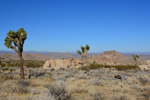
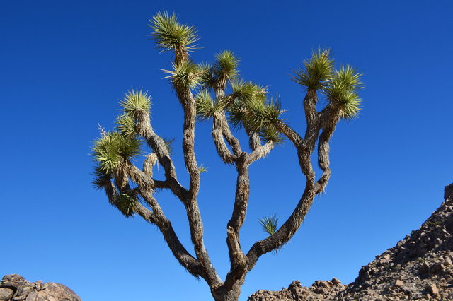
Every turn on the trail showed me a new section of desert, subtly different from what I'd seen before, but still comprised of the same few elements: rock (usually a coarse granite), sand (the same coarse granite, broken down into tiny pebbles that passed for coarse sand), more Joshua trees than I could ever count, yucca, and the occasional cactus (usually cholla or barrel).

The last stretch of trail took me back to the trailhead on an almost-straight line though almost-straight desert, dominated by Joshua trees stretching to the rocky hills in the distance. It was a weird hostile alien landscape that I found so compelling. The often-repeated bumper playing at the beginning of Pseudopod applied perfectly: "It's beautiful, in its own alien way."
I returned to my car by the middle of the afternoon, having hiked (according to my GPS) ten miles across the desert. I drove further into the park, past the aptly-named Intersection Rock (a massive boulder the size of an office building) marking a road intersection in the park, to turn down the Geology Tour Road.

The dirt road descended on a gentle slope to an overlook over Pleasant Valley. Markers along the route identified points of interest in the geological tour of the area, but I neglected to find the brochure with to interpret the markers before setting out on the road. I stopped at at the end of the road accessible by two-wheel-drive vehicles, since it seemed imprudent to take a rental car on a four-wheel-drive road. I pulled out into the little parking lot and looked out into the valley below; I assumed that "Pleasant Valley" must be a joke (possibly at the expense of prospective settlers) since I did not imagine that the arid valley would be very pleasant in summer.

The small dirt parking lot at the end of my road served as the access point to Squaw Tank, a little concrete dam (not more than two meters high and four meters long) blocking a small rock tank where rain water would collect. This was a natural rock tank that had been augmented and then abandoned by settlers.
I turned around and headed north on Geology Tour Road, past the Joshua trees flanking the road in the afternoon sun. This was a tree-lined boulevard for the desert.
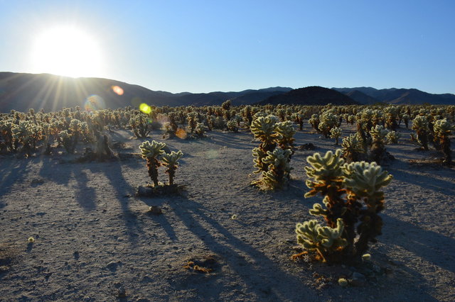
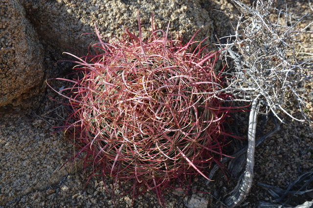
My last stop for the day was the Cholla Cactus Garden, on the dividing line between the high Mojave desert and the low Colorado desert. This was a massive patch of Teddy Bear Cholla, a cactus that looked soft and cuddly like a Teddy Bear but was not, in fact, soft or cuddly. (The Park Service had provided a first aid kit at the parking lot, complete with tweezers to remove cactus spines from visitors who failed to heed the warnings and touched the cactus.) I kept a minimum safe distance from the cactus and did not suffer any adverse events.
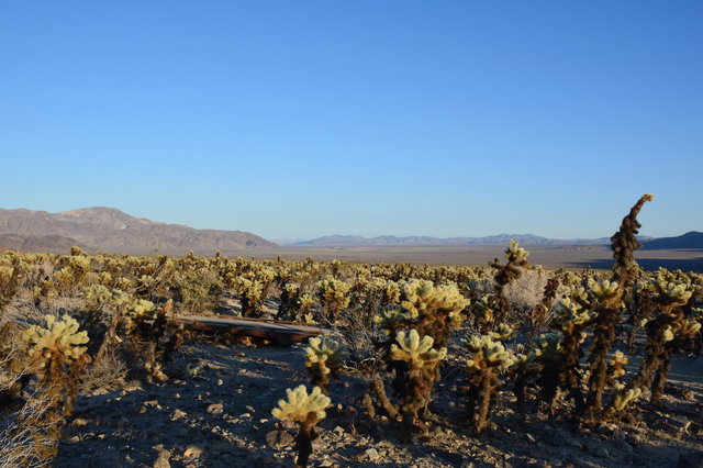
I walked through the cactus garden; then, with the sun beginning to set in the west, I returned to my room in Twentynine Palms; then ate supper in Joshua Tree before retiring for the night.
I took a lot more pictures in Joshua Tree National Park, you can see them all at Photos on 2020-01-11.
