Two deserts
Started: 2020-01-31 23:01:52
Submitted: 2020-02-01 00:45:13
Visibility: World-readable
12th January 2020: In which the intrepid narrator travels from the Mojave Desert to the Colorado Desert, and then onward to the rain
On my last day in Joshua Tree, I drove the long way back to the Palm Springs airport: from Twentynine Palms south into Joshua Tree National Park to I-10, then west through the Coachella Valley to the airport.
I ate breakfast in Joshua Tree, then drove through the park, following the Pinto Basin Road as it descended into the Pinto Basin, crossing from the high desert (the Mojave Desert) into the low desert (the Colorado Desert). I passed the Cholla Cactus Garden, which I visited the day before, and stopped at the Octillo Patch.
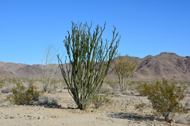
This was just a wide spot in the road with a couple of parking spaces, but it gave me the chance to get out and look at the handful of octillo growing in the desert. The weird desert shrubs were covered in tiny green leaves in the winter growing season; though I couldn't help but think that I saw a better selection of octillo in Anza-Borrego Desert State Park last winter.

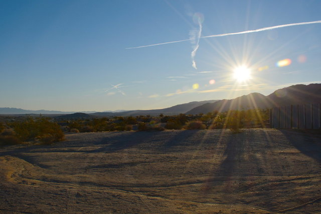
The road descended into Pinto Basin. The flat basin stretched for miles to the east, into the undeveloped portion of the park, bounded on the far end by mountains that marked the end of the park. The map indicated that there was an active mine somewhere in the distance, on the other side of the mountains in the hazy distance, in a peninsula cut out of the national park due to its status as an active mine. But from where I stood along the side of the two-lane paved road running through the desert the only evidence of human development was the road I was standing on, the cars that occasionally drove past on their way somewhere else, and the jetliners flying overhead on their way into and out of Los Angeles. It was a barren, desolate place; but it felt familiar to me, as part of the American Southwest I visited while I was growing up.
I stopped at the Cottonwood Visitor Center on the south end of the park, bought a couple of stickers at the gift shop, and walked around the interpretive garden outside the visitor's center where the cactus and other plants endemic to the Colorado Desert were labeled for my benefit.
I drove out of Joshua Tree National Park with U2's The Joshua Tree playing on my stereo, the music matching the wide-open spaces of the desert as I drove. I regretted having to leave so soon after arriving; I already missed feeling the sunlight on my face and being able to go outside without getting wet.
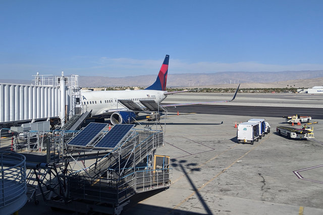
I turned west on I-10 and descended into the Coachella Valley, driving on a superhighway along with truck traffic into and out of Los Angeles. The interstate highway dropped below sea level in Indio without observing the geographic quirk with a sign, then climbed above sea level on its way towards Palm Springs. I returned to the airport for my flight to Seattle.
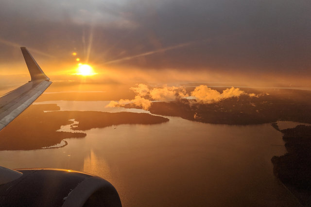
I got to see the sun one last time on my descent into Seattle, when the setting sun peeked through the clouds to illuminate the Puget Sound as we followed the approach path into SEA before turning around to land to the south.
I have a few more pictures of my journey out of Joshua Tree at Photos on 2020-01-12.
