Bridge Creek
Started: 2023-12-17 20:39:54
Submitted: 2023-12-17 22:22:19
Visibility: World-readable
A thanksgiving tradition: Hiking in The Forest of Nisene Marks
Every year for the past three years I've gone hiking in The Forest of Nisene Marks State Park on the week of Thanksgiving.
In 2020 and 2021, I was working for Apple, which gave me the entire week of Thanksgiving off as a bonus holiday. November of 2020 was the rising edge of the winter COVID surge, but by that point it was generally accepted that we could go outside in public as long as we didn't get particularly close to anyone, and there's plenty of space in the state park to maintain distance. I took a long hike up the West Ridge Trail and looped back down the Loma Prieta Grade. In 2021 I hiked to the Loma Prieta Epicenter and then hiked up the fire road to the "top of the incline", marking the site where logging engineers built a cable-pulled inclined railway used to move lumber out of the forest. In 2022 I returned to the epicenter with my children when my family visited us for Thanksgiving.
This year for Thanksgiving we visited my in-laws in Mount Vernon, Washington; so I made time to visit The Forest of Nisene Marks on Sunday before Thanksgiving to fit the "week of Thanksgiving" tradition.
I parked at the tiny trailhead at the winter gate and walked up the fire road on foot, crossing Aptos Creek on the Steel Bridge suspended high above the creek. I followed the fire road to the junction leading to the Loma Prieta epicenter, which turned out to be marked as closed because the state park was concerned about erosion after the recent rain.
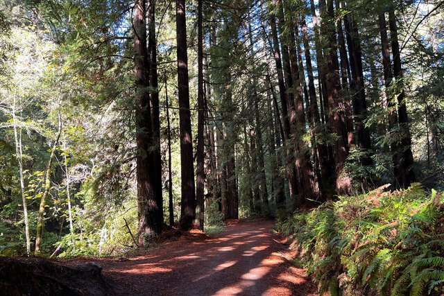
I headed back down the fire road to the Loma Prieta Townsite, then turned up the Bridge Creek Trail, a new-to-me trail heading up the narrow valley carved by Bridge Creek before it joined Aptos Creek. The entire valley (like most of the land that is now the state park) was logged at the end of the nineteenth century; I walked among the second-growth redwood trees, reaching high above me in their quest to find the sun. The trail was cool and pleasant. Half-way up the valley the trail crossed the creek at a ford, then continued up the opposite hillside to follow the creek up the valley.
My destination was a spot marked vaguely on the park map as "Bridge Creek Historic Site", more than a mile up the valley from the Loma Prieta Townsite. What I found was a stack of sturdy redwood logs, which appeared to be stacked like Lincoln Logs in a pier supporting a much larger log stretching across the hillside above the creek. Whether this was the bridge that made up historic site, or something else entirely, wasn't clear, and there were no interpretive signs that would help me understand why this site was even marked on my map and what historic significance it held.
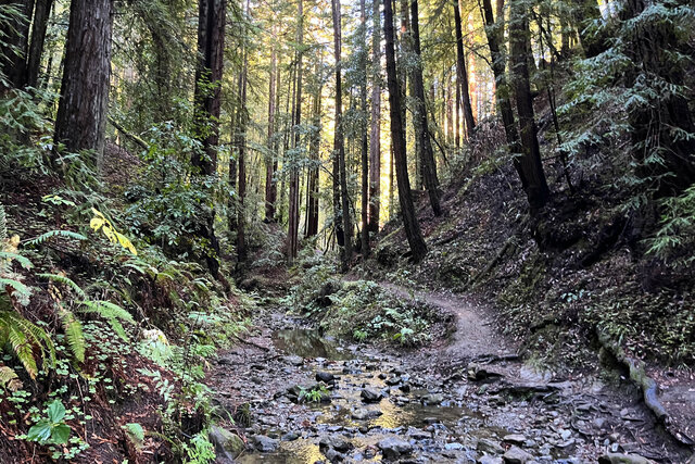
Above the site was a three-way junction leading to Maple Falls, but this dead-end trail was also marked as closed to prevent storm-related erosion. I figured I had gone far enough already, but I wanted to turn my hike into a loop so I crossed Bridge Creek again (this time on a narrow log forming a shaky bridge across the creek; I stood on the tiny bridge and watched the water flowing languidly beneath my feet while I took the picture below) and headed up the hillside to join the end of the trail following the Loma Prieta Grade.
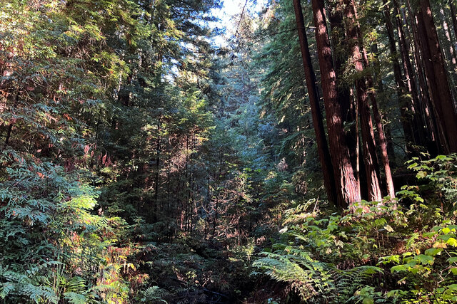
The forest changed dramatically on the hillside above the creek. It was still second-growth redwood, and there was little light on the forest floor, but there was much more space between the trees, and as I climbed the the hillside leveled out to give the impression of an urban park. My best guess was that this was the result of deliberate forest management intended to recreate the effect of regular low-intensity fires: the forest floor was clear of low brush and covered in a thin layer of leaf litter, denying a future fire the fuel it would need to grow into a high-intensity crown fire. (Actually performing controlled burns in the forests of Santa Cruz County is fraught with peril as human habitation continues to push the wildland-urban interface into the forest, but the state parks have managed to do some burns this fall.)

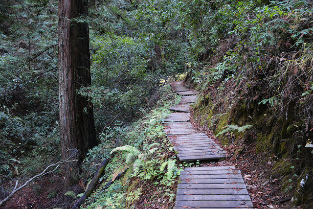
The trail clung to the contours of the hillside, zigzagging back and forth as small valleys carved by intermittent creeks intersected the trail, flowing to the larger creek below. At times the trail had been carved out of the hillside and clung tenaciously above a precipitous drop. Some of the trail was cut through a gap in the hillside. At one point the surface of the trail was paved with what looked like plastic boards from a home deck, presumably to limit erosion on the narrow trail, giving the impression of a boardwalk placed on the side of the hill.
As I hiked back to the trailhead the trail joined other trails and eventually rejoined the fire road. By the time I reached my car my handheld GPS receiver indicated that I had hiked ten miles (subject to the limitations of its ability to receive a GPS signal in the forest), which was somewhat longer than I had intended, but I had a good hike in the forest, and I upheld my Thanksgiving hiking tradition once again.
