Have ice ax, will travel
Started: 2010-07-16 20:51:36
Submitted: 2010-07-16 21:43:09
Visibility: World-readable
Every couple of months, while studying the snow-capped mountains capping the western horizon, I spot a new mountain in the middle of the mountains I can already recognize. Around Christmas I spotted the Mummy Range (best viewed from east of Longmont) and figured out that, if I squinted just right, it did sort of look like a reclining mummy. A few weeks ago I realized I could see Apache Peak and Isabelle Glacier, and when I looked just right, the Queens Way couloir climbing from the glacier to the summit. (I had previously assumed that the glacier and summit were blocked by Shoshoni Peak, but a careful analysis of the geography revealed that not to be the case.) I approve of previewing my routes before climbing them, and this proved to be a special case that I couldn't resist.

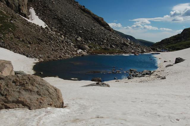
Queens Way was already on my checklist for the early-summer snow-climbing season. I set out early Saturday morning, 10 July, for Brainard Lake Recreation Area, stopping for coffee along the way. The Long Lake Trailhead was already full at 07:30, so I parked at the lake and walked the extra half-mile to the trailhead. I saw a handful of people on the trail in the early-morning light. I pressed past Lake Isabelle (one of my family's favorite afternoon-hikes growing up in Boulder) into the upper valley toward Isabelle Glacier. When I reached the tiny basin where the trail headed off to the right to climb steeply to the glacier itself, I crossed the tarn and followed the tracks up the snow slope on the far end of the valley.
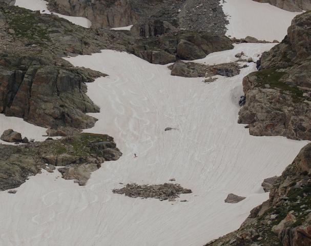
I spotted a trio of skiers ahead of me as I crossed the tarn, and when I stopped to grab my ice ax they took a direct approach up the end of the valley, skirting to the left of the big snowfield, to another tiny basin below Navajo Peak. I got a hundred meters up the snow slope before it got steep enough that I stopped to don my crampons. I climbed the slope and contemplated my ascent route. I could follow the snow up to the right to the mid-point of Isabelle Glacier and follow Queens Way up there, as had been my plan, or I could swing to the left, into the basin below Navajo Peak, and climb the Apache Couloir. Though not part of my original plan, the couloir seemed to be in excellent condition and felt like a better training climb for future steep snow routes I might be tempted to climb. I scrambled over rock for a few hundred meters to the base of the couloir, surveyed the route ahead of me, and began climbing.

By the middle of July, the snow in the couloir had consolidated into a firm cement, and previous tracks from backcountry skiers had plowed off the soft upper layer on meters of snow at a time, leaving an uneven ascent surface. I quickly switched from my ice ax in cane position to stake position as the slope grew steeper, and followed the main branch of the couloir as it wound its way up the side of the mountain. Kicking steps into the solid snow was difficult; I was glad to have the front points of my crampons for purchase, even as I strained my calves trying to remain upright on the slope.

I watched the conical summit block of Navajo Peak, and the odd little pinnacle of rock known informally as "Dickers Peck", rise to my left as I climbed, only to be quickly eclipsed by the rock walls of my couloir. I continued climbing and kept wondering how long I would see ski tracks. Just as I was beginning to worry that I would never reach the summit, the couloir abruptly ended and I found myself on a broad snow slope reaching gently for the ridge leading to Apache Peak. I climbed the remaining several hundred vertical feet to the ridge, then shed my crampons for another few hundred vertical feet to the summit. (The ski tracks started at the ridge and went all the way down the couloir.) It was 11:00, and the last thousand vertical feet took nearly an hour and a half.
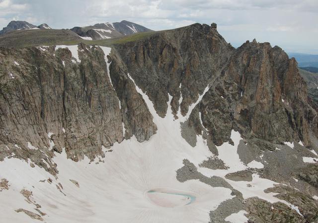
I found two unremarkable piles of rock that could be the summit and found the summit register under the pile to the north-west. Two climbers who had ascended Queens Way arrived as I was scanning the two-year-old register for names I recognized. (I failed.) I surveyed my surroundings, trying to recognize mountains. The nearest higher point was North Arapaho Peak, just to the south.

I looked north, down onto Lone Eagle Peak from above, where the giant imposing pinnacle looked like a minor arête, barely distinguishable from the surrounding rock. Longs Peak and Mount Meeker were socked in with a late-morning rainstorm, but the rest of the peaks along the way were bathed in light.

I descended a few meters to the east and found a good place to eat lunch. I used my GPS receiver to guide me to the top of Queens Way and caught an impressive view of Shoshoni Peak and heard the siren call of the couloirs on its west face before dropping into the snow.
I don't yet feel comfortable glissading down snow, especially when I'm uncertain about the runout, so I descended at a modest pace, keeping my ice ax ready for balance and self-arrest. The snow was firm and rutted but I kept my balance. I veered off Isabelle Glacier onto the unbroken snow slope that took me all the way down to the unnamed tarn and the end of the snow. I removed and stowed my crampons and ice ax and surveyed the mountain I had climbed.

As I watched, and worked on a post-lunch snack, a trio of skiers descended, one at a time, the snowfield I had just descended.
I made my way back to the trailhead and returned to civilization, happy to have successfully made a classic tour of Apache Peak. I checked the second-highest summit in Indian Peaks Wilderness off my list and started looking for my next climb.
