Big Basin
Started: 2023-05-16 19:16:56
Submitted: 2023-05-16 21:33:29
Visibility: World-readable
Visiting California's oldest state park after the CZU Lighting Complex fire
Early in the morning on the 16th of August 2020, the day my kids arrived in Santa Cruz County, a dry lightning storm swept across Santa Cruz County from Monterey Bay, bringing wind and lightning to the mountains around my new home. The wind toppled branches and knocked out my power for a couple of days, and the lightning struck multiple wildfires across the county. The fires found brush grown thick by a century of forest mismanagement and dried out by drought, spreading quickly into a massive conflagration that destroyed homes in the county and triggered a massive evacuation, and turned the sky above San Francisco an unnatural shade of orange as if to herald the end of days. It was a sudden, unexpected cataclysm within the longer, slower-moving apocalypse that was the rest of 2020.
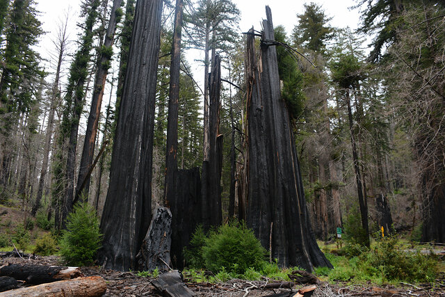
Among the casualties was Big Basin State Park. The park identifies itself as California's first state park, born out of a desire for conservation at the turn of the last century, as Santa Cruz County's old-growth redwood forests were being cut down to serve the rapidly-expanding cities around San Francisco Bay. The park preserved old-growth redwoods and the surrounding forest, and built visitor's facilities cherished by generations of visitors. The CZU Lightning Complex fire destroyed the human infrastructure and charred the trees, but the towering redwoods survived this conflagration just as they have survived others through the millenia.
Last summer the state park service reopened part of the park, centered around the old-growth redwood grove and the old headquarters area, with a small network of trails running through the damaged forest where they could rebuild the trail and mitigate any hazard trees that might fall on the trails. The park operated on a daily reservation system, offering as many reservations each day as they had spots in the parking lot, to manage visitors. Then in the winter of 2023 a series of storms drenched Santa Cruz County, finally breaking three years of drought but bringing mudslides to hillsides where the underbrush had burned away and toppling trees damaged by fire. The park closed for much of the winter before reopening again this spring. I picked up a parking reservation for an upcoming weekend when I got the chance — then a day later I saw the news that the park had reopened even more trails.
We set out on Saturday morning, the 6th of May, to drive up the San Lorenzo Valley to Boulder Creek, then turn west to drive the rest of the way to Big Basin. (Despite living in Santa Cruz County for the better part of three years, I haven't yet driven up the valley past Felton.) The bottom of the valley had been spared from the fire (though it had been evacuated for safety), but as we drove up the hillside suddenly we crossed into the perimeter of the fire. The road was flanked by blackened tree trunks and most of the underbrush was cleared, except that which had grown back in the past two years.
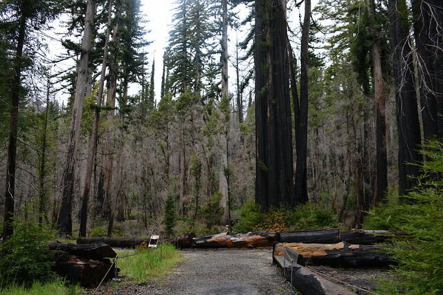
Approaching the headquarters area on Highway 236 the road passed through a stretch of burned forest with side roads leading to campgrounds and other visitor's facilities on both sides of the road. The roads were closed by heavy gates festooned with no-parking signs, and beyond the gates the roads hadn't been cleared of leaf litter (and possibly fire debris). I got the impression of a ghost town or ruins; clearly something had been here once but it was no longer in use.
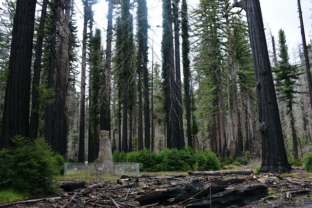
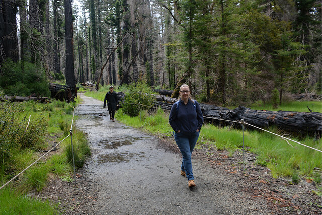
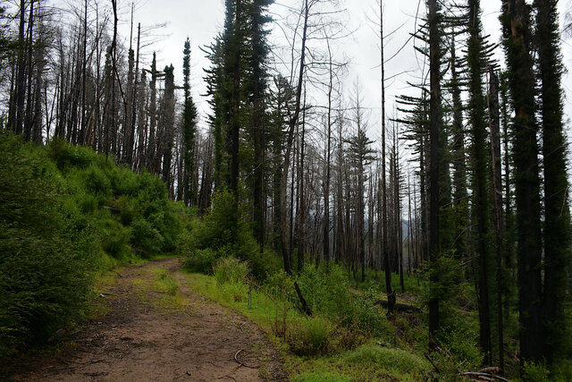
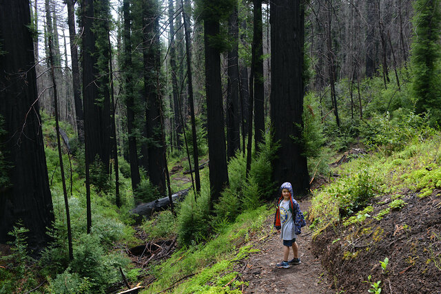
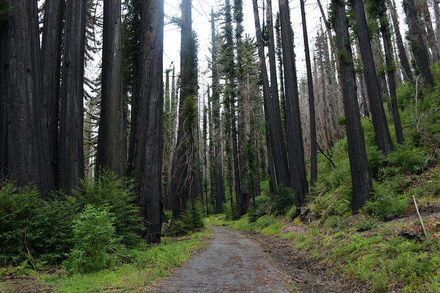
We parked at the headquarters area, between trees blackened by the fire and some obviously-temporary structures set up for visitors, screening a row of portable toilets. I had no frame of reference for what the headquarters area used to look like before the fire except for some clearings between the redwoods next to the parking lot, and one stone chimney still standing next to the empty space where its building used to be. There was a map showing the open trails, but it wasn't immediately obvious how the trails emerged from the parking lot. We ended up on the redwood loop trail, giving us a close-up view of the redwoods recovering from the fire.
The ranger at the entrance station told us that 98% of the redwood trees had survived the fire, but the fir and pine trees hadn't done as well. Mature coast redwoods grow with thick fire-resistant bark; after the fire the tree regrows branches through the burned trunk. The branches gave the impression that the trees were wearing a furry sweater.
It rained overnight, leaving muddy puddles on the trail. My hiking shoes are not as waterproof as they ought to be, but we all made it through the day without any problems related to wet footware.
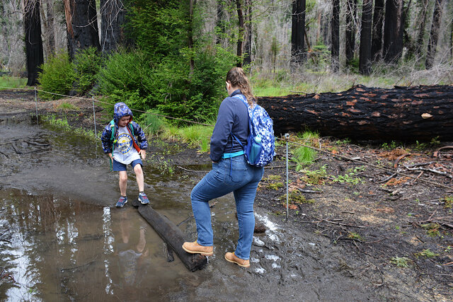
Calvin wore sandals, even after I told him that we would be hiking at least four miles. Three-quarters of the way through the hike we encountered some slippery mud and he began to slip and remarked that perhaps the sandals didn't have quite the tread they needed to have. I said something like "Hmm" and Kiesa interpreted, "That sound is Dad saying 'I told you so.'"
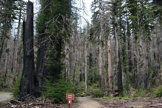
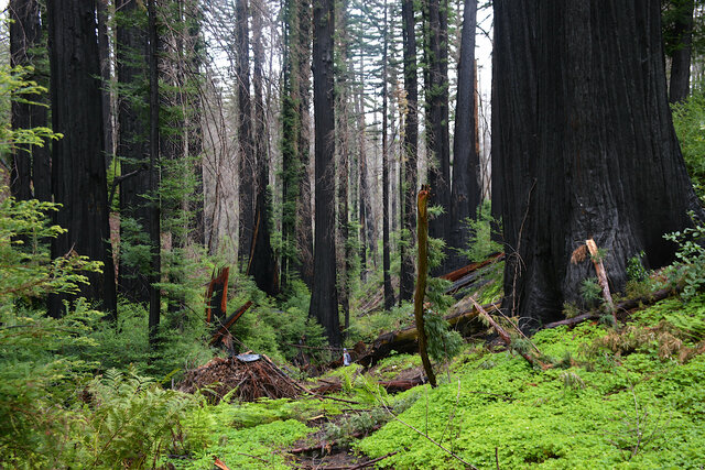
After completing the redwood loop trail I found the actual route of the trail I had intended to take, the Dool Trail, leading north from the parking lot along Opal Creek before turning to climb the hill above the creek. As we walked there was evidence of recent brush-clearing work in the forest: circles of ash on the ground where slash piles had been burned, and further up the trail, the slash piles themselves, waiting to be burned when the conditions were right.
Some trees had clearly been cut down after the fire; their stumps were unburned. Some had been downed before the fire; their stumps were completely charred, and I could see the pattern of the fire as it burned the wood grain. On the fallen trees we crossed I considered counting the rings, but that seemed like too much work.
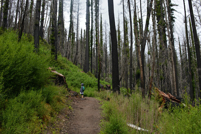
This was the day of the coronation of King Charles III, and I wondered how many of the trees we passed were older than the entire English monarchy. (And then I wondered how far I had to go back to say "older than the English monarchy": do I need to count the Battle of Hastings, or the Restoration? I asked my historian on speed-dial (my brother Willy) and he said the Glorious Revolution, and that's easy, I saw plenty of trees that were obviously older than the House of Orange's ascendency onto the English throne.)
The Dool Trail ended at a T junction at Middle Ridge Road. We turned to the right and continued ascending the ridge in search of the point on my map marked as Ocean View Summit. On the ridge the forest gave way to scrub brush. The clouds that brought the previous day's rain still lingered overhead; the air was thick with moisture and the clouds obscured our view of the ocean to the west.
I realized too late that we had passed Ocean View Summit, which must have been a minor local maximum on the ridge, rather than an obvious point of reference. (It's also possible that any interpretive signs might have burned in the fire, though at this point on the mountain the scrub brush showed less signs of fire, presumably because it regrew in the two summers since the fire.) A large fallen tree blocked the trail, and there was a clear social route just to the side of the trail that scrambled up and over the tree with minimal effort, but Julian wanted to plot his own route over the tree. He considered several options, including sliding under the tree (between the muddy ground and the carbonized trunk, which would have gotten him rather dirty) before I finally convinced him to grab my hands and I could help pull him over.
We stopped to eat lunch at a wide spot on the road, at another local maximum, then considered our route back to the car. We could go back the way we came, or we could make a loop with the Meteor Trail ahead of us. The trail had just reopened (again) after the winter storms, and the map at the parking lot warned that the trail was still encumbered by fallen branches and would not be as easy to navigate as other trails in the park. Julian thought that sounded like fun.
The trail followed Rogers Creek down the ridge into the valley below. The fire had clearly burned straight through the creek, but all of the redwood trees were regrowing their lower branches, and the whole hillside was covered in ferns and undergrowth, occasionally encroaching onto the trail. The new growth was a bright vibrant green, contrasting against the blackened trunks of the trees. The creek ran to our left as we descended, and the recent rain still clung to the brush as we passed.
There were some fallen trees around the trail, and an occasional small branch at ankle level threatening to trip us as we walked past, but very little that we actually had to pay much attention to. Julian ran down much of the trail and only scraped his knee once.
At the bottom of the trail we joined the North Escape Road. Here multiple mature trees had fallen across the road, with trunks four feet in diameter, and narrow paths had been cut through the trees, wide enough to form a trail, as if we were navigating a large maze.
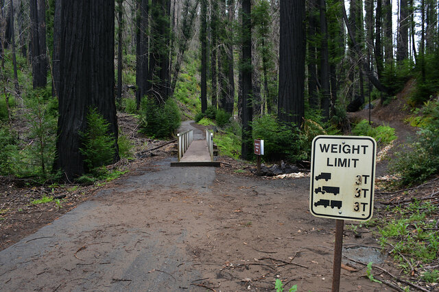
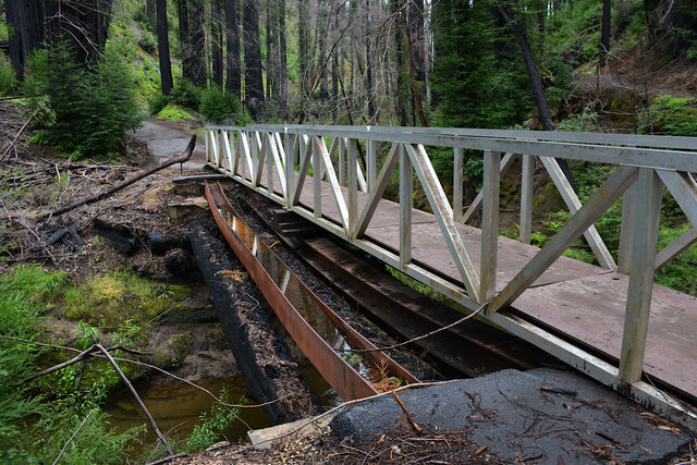
The North Escape Road crossed Opal Creek at the site of a bridge that did not survive the fire. An old weight limit sign looked like it had survived the fire; the number stickers were blistered from the heat of the fire. The sign clearly overstating the carrying capacity of the current temporary bridge.
The temporary bridge was an aluminum truss spanning the old piers on either side of the creek, resting on one of the two sagging steel beams stretching across the creek above a pair of even-older large wooden beams. The steel beams were clearly bent from their original load-bearing positions, having apparently been heated enough during the fire to bend out of shape.
We followed the Skyline to the Sea trail back to the parking lot, then headed back down the mountain to Santa Cruz. I expect I'll get to see Big Basin regrow and redevelop, and i appreciate getting the chance to see it now so i can see its progress over the coming years.
