Whitehouse Pool
Started: 2023-08-09 20:11:54
Submitted: 2023-08-10 19:16:59
Visibility: World-readable
Kayaking in Tomales Bay
At the end of July, Kiesa took the kids to visit her parents for a week. I took the opportunity to take Monday off work and go camping at Point Reyes. I found exactly one tent-only campsite available for one night only at Samuel P. Taylor State Park, which gave me the chance to spend two days kayaking, amortizing the two-and-a-half hour drive (one way) over two days.
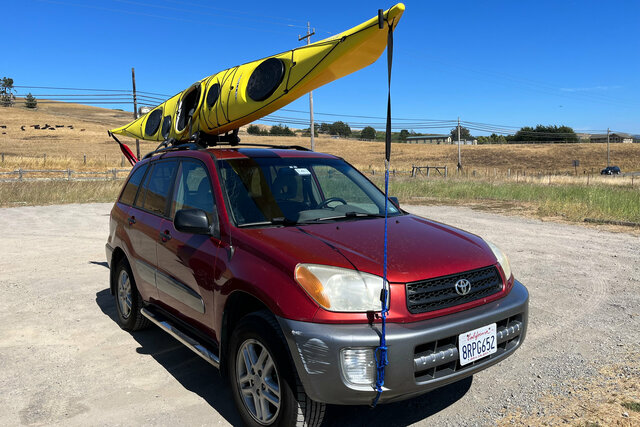
On Sunday, the 30th of July, I drove to Tomales Bay, separating Point Reyes from the mainland. (The easiest way to get to Marin County from Santa Cruz is to drive up I-880 in the East Bay, then head across the Richmond-San Rafael Bridge.) I parked at Whitehouse Pool, a small Marin County park on the Lagunitas Creek where the creek gently flows into the southern end of the bay.
The park advertised itself as a kayak launch location, which turned out to be a steep bank dropping down to a tiny muddy beach. It looked awkward, but it turned out to be easier to launch than I feared when I first saw the bank.
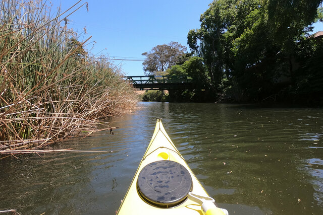
The tide was coming in when I launched, and the water was moving gently upstream with the rising tide. I paddled upstream, along the willows and cattails lining the bank, past the houses that backed up to the creek (some with their own ladders, stairs, or boat docks leading down to the creek), until I reached the steel truss bridge carrying highway 1 over the creek. I paddled under the bridge, then turned around and paddled down the creek.
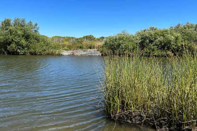
Downstream of Whitehouse Pool the creek turned to the north, heading towards the end of Tomales Bay, and I began to feel the wind from the north. The trees fell back from the creek bank, leaving grasses stretching out from the banks as the creek flowed into a grassy plain. The wind whipped up tiny waves on the creek as I paddled onward, pushing my way against the wind on my way towards the bay.
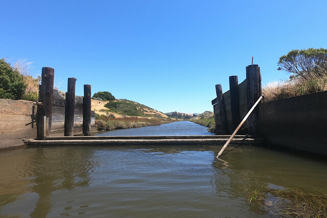
The creek flowed onward into the bay, and I paddled against the wind until I reached an interesting water diversion structure protected from the wind by a small hill between me and the rest of the bay. This structure looked like a weir at the end of a canal running down the opposite side of the grassy plain, though the ground on the left side of the structure (hidden behind the concrete wall in the picture below) had eroded, allowing water to flow behind the wall and equalize levels on both sides of the weir. This part of the bay used to be a pasture for dairy cows, protected from the water by a series of dikes, until the National Park Service acquired the land and began to rewild it by breaking the dikes and restoring the marshes.
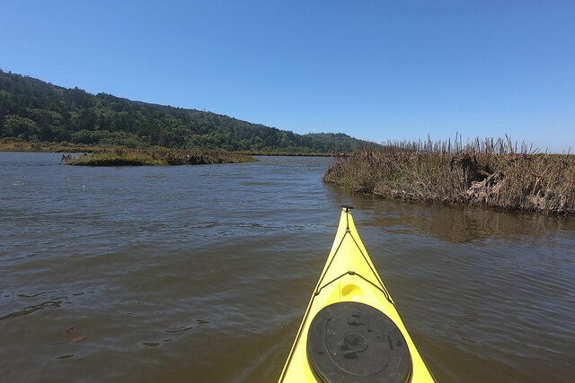
I continued onward into Tomales Bay and took a right turn at a three-way Y junction that seemed to be Lagunitas Creek's delta. This channel was somewhat more protected from the wind coming down the bay, and took me along a dike that used to protect the pasture behind it, before I reached the obvious break in the dike where water was flowing into the pasture that was turning back into a tidal marsh.
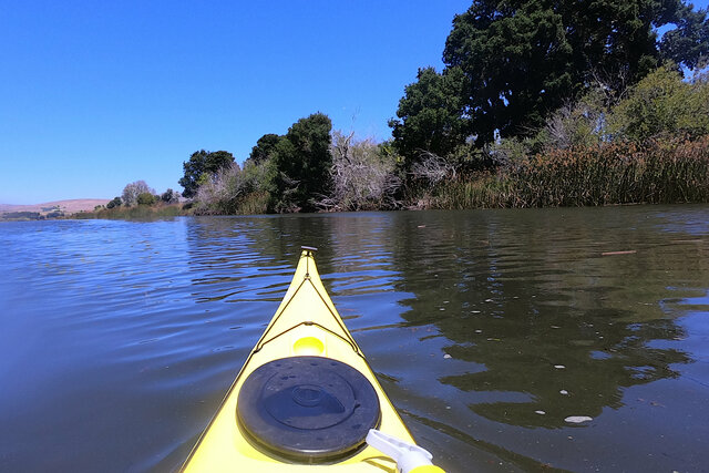
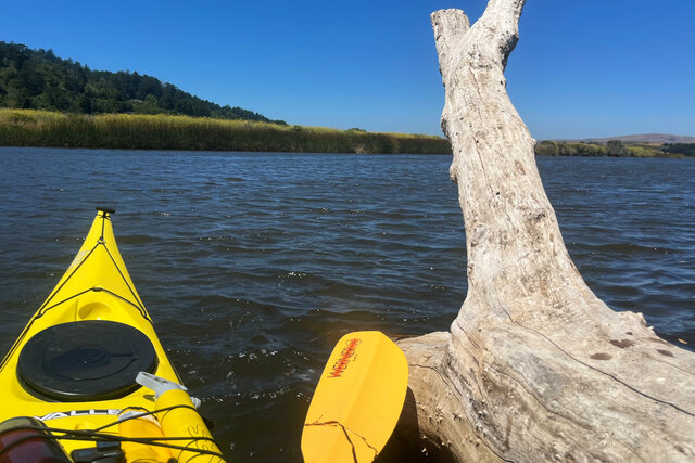
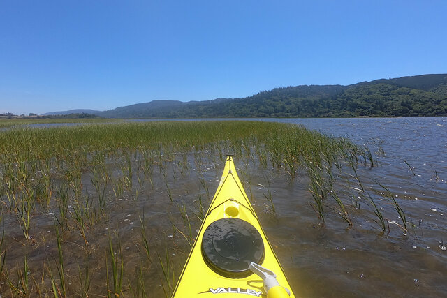
At last I paddled into Tomales Bay. The bay stretched to the north ahead of me, fading into the hazy distance. I was in the middle of the rift valley formed by the San Andreas Fault; the land to the west (forming the bulk of Point Reyes) had traveled hundreds of miles north against the mainland to the east. (In Santa Cruz I also live on the seaward side of the fault.) The wind whipped up small waves (still only a couple of inches tall), and I paddled into the eelgrass growing in the shallow water, providing some protection from the wind and waves while I ate a snack.
I crossed to the main branch of the creek and turned south, paddling with the wind at my back, returning to my car. This time the wind pushed me along, mostly steering me in the correct direction down the creek. I stopped on a little beach in the middle of the creek to refill the water bottle I had lashed to the deck of my kayak (I only had a one-liter Nalgene, but I brought extra water in one of my cargo holds), then continued up the creek.
As I approached the last turn in the creek before Whitehouse Pool I saw splashing in the water ahead of me. At first I thought it was a bird on the surface of the water, but it stayed in place rather than flying away. I was puzzled for a moment until I got close enough to realize that it was someone swimming in the creek, heading in the same direction I was going, though I was faster on the water so I overtook them as I paddled up the creek.
I returned to the tiny beach at Whitehouse Pool and pulled my kayak out of the water and hoisted it onto my car.
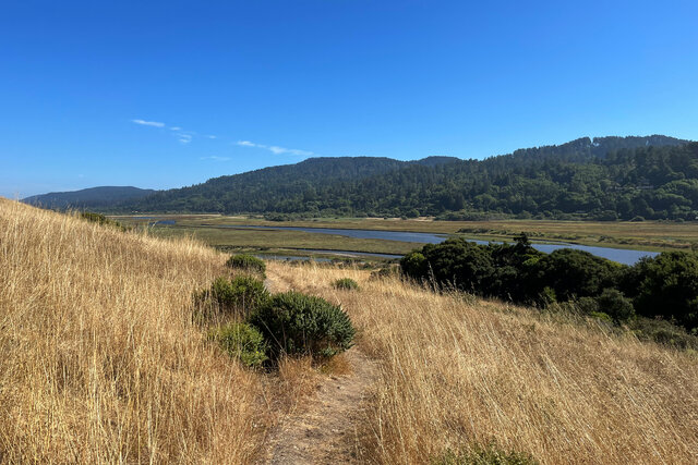
I drove up the east side of Tomales Bay to the Tomales Bay Trail, which led from a trailhead off highway 1 across the golden-brown hillside above the bay, in between the pastures being returned to marshes. The wind still whipped down the bay and across the hill but I was standing firm on solid ground so it didn't affect me as much. The trail leading down to the edge of the marsh at the edge of the creek gave me a new perspective on the creek that I had just paddled; I could see the tendrils of the tide flowing up into the pastures, which had been mostly invisible to me on the water except as a glimpse of a channel of unknown depth heading through the breech in the dikes.
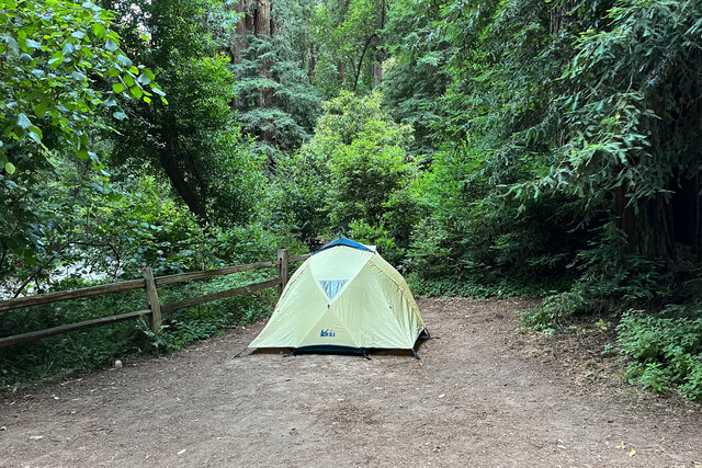
I drove up Lagunitas Creek to Samuel P. Taylor State Park, where I found the tent campsite I had reserved (number 22, on a little loop on the opposite side of the creek from the main road leading up the valley). After supper I walked down the creek and back, before retiring in my tent ahead of a second day of kayaking.