Schooner Bay
Started: 2023-08-11 22:45:14
Submitted: 2023-08-12 17:35:25
Visibility: World-readable
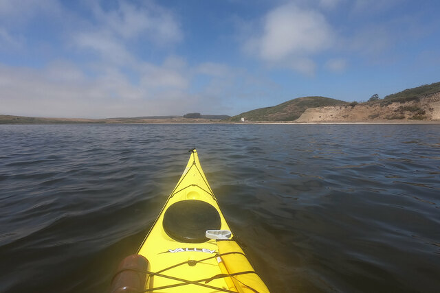
Kayaking on Drakes Estero, where I saw leopard sharks and so many seals
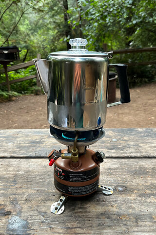
I started the last day in July in the campground at Samuel P. Taylor State Park, near enough to Point Reyes that I could kayak two days in a row without going all the way back home. My first objective was to cook breakfast, which meant starting with coffee. (This means that I have a picture of this percolator coffee pot brewing coffee on a camp stove on the first and last day of July.)
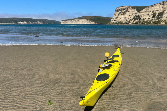
I packed up my campsite and drove down Lagunitas Creek into Point Reyes National Seashore to the Oyster Farm parking lot in Schooner Bay on the north side of Drakes Estero. (I kayaked on Drakes Estero once before, as part of a guided tour in 2018.) I hoisted my boat off my car and carried across the parking lot to the beach. (This is the most awkward part of every kayak trip. My kayak weighs about 50 pounds, which is within my capacity to lift it and carry it around, but it is 17 feet long which makes it awkward to lift it above my head. I have a cart that I use to move my kayak around on shore, which breaks down into pieces so I can stow it in the cargo compartments of my boat, but at Drakes Estero I parked close enough to the beach that I didn't feel the need to break out the cart to get to the beach.)
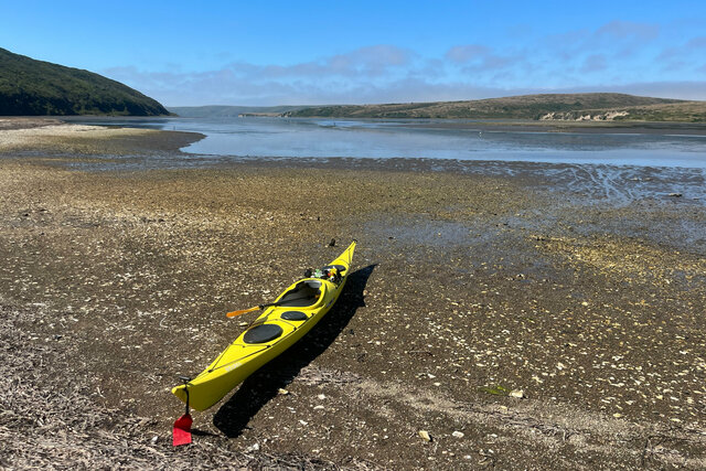
Actually launching my kayak into the water proved more difficult than I expected. I pulled my boat down the beach towards the edge of the water, but before I reached the water, I began to posthole in the mud. At first I only sunk a couple of inches into the mud, and ankle-deep mud seemed reasonable, but soon I ended up knee-deep in the gooey mud with some distance left between me and the water, and I decided that I had to abort and find a better way to get my boat into the water.
I found a better way into the water a few dozen meters down the beach, where the beach was steeper and the ground firmer, letting me reach the water without getting enveloped in mud along the way.
I pushed out into the water and began heading south, down the length of Drakes Estero, in the general direction of the Pacific Ocean several nautical miles away.
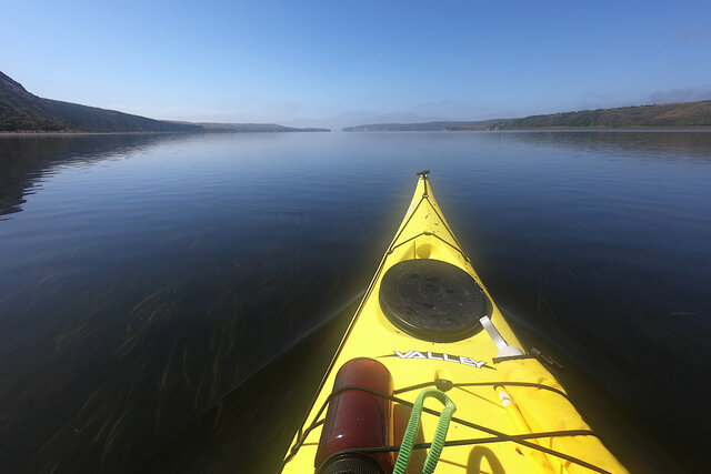
At this point in the trip, just as I was getting into my paddling rhythm and I had begun to pull out my GoPro camera for some pictures on the water (I kept it lashed to the deck of my kayak for easy access, with an arm that was supposed to float if it ended up in the water, but its location on the kayak deck meant it got splashed with water, and most of the pictures I took are a bit soft-focus fuzzy because of water smearing the lens), the LCD on my camera turned black and stopped responding and I couldn't get it to power on and off. (I think it may actually have still been working, because I had a bunch of nearly-identical pictures that look like I must have taken them while fumbling with the camera floating in my kayak in the middle of Schooner Bay.) I carefully pulled the camera out of its mount, pulled the battery door open, pulled out the battery, and pushed the battery back in. This was enough to reset the camera; it booted right up and I was able to use it for the rest of the trip.
When I was half-way through Schooner Bay, with eelgrass waving in the calm waters beneath me (pushed gently back in the direction I was coming from by the rising tide that I was paddling against), I began to notice tiny fins sticking above the water ahead of me. I wondered if they were bat rays, but soon I figured out that they were leopard sharks, the cute 3-or-4-foot-long sharks that are a staple of aquarium kelp forests. Most of the time they stayed just far enough away that I couldn't see them; the surface of the water reflected the sky and all I could see was their tiny dorsal fins rising two inches above the glass-smooth water as they hunted in the shallow water, like a small-scale reenactment of Jaws. I saw dozens of fins, all swimming back and forth ahead of me and on both side. I could catch a glimpse of a shark if one got close enough that I could look straight down and see it swimming beneath my kayak. Sometimes the shark would be swimming lazily in my direction, just close enough that I could see it for a fraction of a second before it suddenly noticed me and executed an immediate 180-degree turn. (I don't know how the shark missed me until I was close enough to see it; I was paddling in a 17-foot yellow kayak.)
I saw one shark swimming under my boat, heading in the same direction I was going but much faster. I was paddling along at a decent speed, probably three or four knots, and the shark overtook me at speed like I was standing still in the water. Rarely have I felt so humbled by a marine animal.
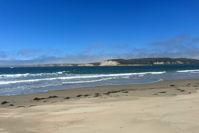
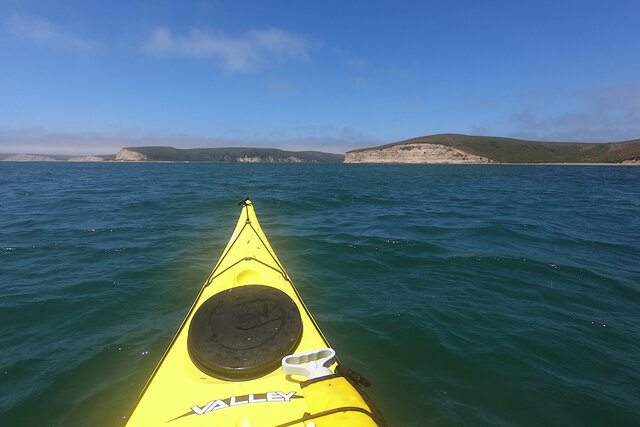
Soon after the shark overtook me at speed the water opened up, with the arms of Home Bay to my left, and the smaller Creamery Bay to my right. I continued paddling south, down the main axis of the estero, in the direction of the ocean. I could just make out the beach at mouth of the estero, between the cliffs on either side of the water, two nautical miles away to the south.
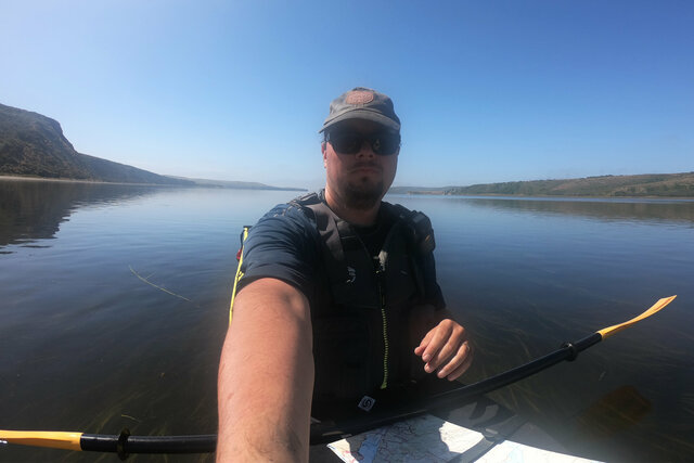
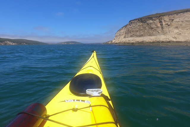
As soon as I left Schooner Bay and paddled into the main body of Drakes estero, I began to see harbor seals, positioned in what looked like a picket line running the entire length of the channel, watching me approach. In the water, harbor seals look like streamlined dogs, perfectly adapted for swimming, their heads darting back and forth as they evaluate their surroundings. (Once or twice I got close enough to hear a seal sneeze.) In the distance, under the cliffs below the Sunset Beach Trail, I saw scores of harbor seals hauled out on the beach; then after I passed they flushed the beach and dove into the water in a series of wild splashes behind me, half a mile away from where I paddled in the middle of the estuary.
I stayed in the middle of the estuary, far from the cliffs on either side, to avoid the beaches and any possible interactions with the harbor seals there, but this meant I found myself in the shallow water in the middle of the main body of the estuary. (The deepest water was immediately offshore of the cliffs on either side.) My kayak will float in six inches of water, but it's awkward to paddle in less than two feet of water. The tide was still coming in, and I could see the sandy bottom coming closer and closer to the surface. The water was never shallower than a foot, but it was enough to make me think about where I put my paddle in the water.
I passed the cliffs above Sunset Beach, and swung wide to the west to avoid the shallows in front of the beach, marked as mud flats at low tide on the waterproof topographic map I held in my lap on my spray skirt as I paddled. I was close enough to the mouth of the estero that I could see the sandy beach on each side, with a narrow channel with breaking waves in between.
I decided that I wanted to land on the opposite shore, on the back side of Limantour Spit. This involved crossing the estero directly behind the mouth, where the swells from Drakes Bay threatened to push me closer to shore than I wanted to go, close to the kelp forest beneath the cliffs and the waves breaking on Sunshine Beach. I pressed steadily forward, charting my progress on the beach to my left. Eventually I crossed behind the tip of Limantour Spit and the waves diminished; by the time I landed on the sand on the back side of the spit the water was calm.
I beached my kayak and stepped out onto the sandy beach, the first time I stood on dry land after paddling for an hour-and-a-half, traveling three-and-a-half nautical miles down the length of Drakes Estero. I took a walk around the dunes at the tip of the spit, surrounded on three sides by water: Drakes Bay and the vast Pacific Ocean to the south, the channel at the mouth of Drakes Estero to the west, and the end of Limantour Estero to the north. Waves from the bay broke on the bar in front of the mouth of the estero. It felt remote but there were two other people sitting on the dunes at the end of the sandy spit, and a third person approached on horseback while I was eating lunch.
After resting and refueling on the beach, I returned to my kayak to paddle back to my launch site. The tide had gone out while I was on shore, so I had to drag my boat back to the water to launch. While my boat was in the water, but before I launched, I cleaned my kayak's skeg and checked that I could deploy it using the lever next to my cockpit. (I had tried to deploy the skeg, to help keep my boat pointing in the same direction in the face of the wind and the waves, but it was stuck.)
I set out into the water, retracing my path across the channel behind the mouth of the estero. The wind had picked up, blowing from the north-west, which was approximately the direction I wanted to head. (The wind wants to treat my kayak like a weather vane, pointing the bow straight into the wind, which is often inconvenient if I don't want to paddle directly into the wind. The skeg acts as a fixed keel to counteract the effect of the wind, keeping my boat pointed in the direction I want.) I crossed the channel steadily, and soon I was on the other side approaching the cliffs next to Sunset Beach.
The tide had risen since I had paddled across the shallows in the middle of the estuary. I could still see the sandy bottom beneath my boat, but I was no longer in danger of hitting the bottom as I paddled normally. A breeze had picked up from the north, blowing against me as I paddled. I set my skeg to keep my boat pointed in the same direction and paddled north, through the main body of Drakes Estero, between the cliffs on either side of the water, past the mouth of Home Bay to the east, and onward into Schooner Bay, until at last I reached the muddy beach next to the parking lot.
The tide had risen enough since I launched that I floated right over the mud and landed on the upper portion of the beach covered in fragments of oyster shells from the commercial oyster farm that operated in the bay for decades. I hoisted my kayak onto my car and drove back home to Santa Cruz (across the Richmond-San Rafael Bridge and down I-880 down the East Bay), after an amazing day kayaking on Drakes Estero.
I have a few more pictures from kayaking on Drakes Estero at Photos on 2023-07-31.
